
About this walk
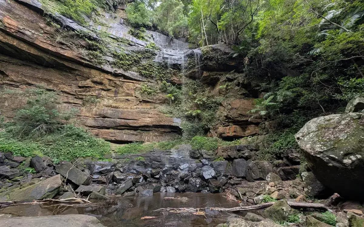
A beautiful rainforest walk full of ferns, small caves and green walls. There are a lot of stairs. We took our three year old and they were fine, maybe because it is all a bit challenging and whimsical. There is a campground nearby: Gap Creek Campground.
Directions
- Start at the end of Bangalow Road (a four wheel drive is best if you have one): -33.01325188365708, 151.43067598342898 (Google Maps)
- Turn left to head down to the falls: -33.010264959453025, 151.43131971359256 (Google Maps)
- The falls: -33.009401251670894, 151.42889499664307 (Google Maps)
Can you swim here?
The pool at the bottom was very muddy. I was about to go for a muddy swim anyway when our daughter picked up a few leeches, and I decided against it. We did see a beautiful eel in there. I'll come back for the falls, but not for a swim.
Elevation
- Climb
- 0 m
- Descent
- 90 m
- Highest
- 268 m
- Lowest
- 179 m
Approximate, from a 30 m terrain model, so it can overstate the climb on cliff edge tracks.
Before you go
Tell your people where you are going
Set your route and return time in FriendsFindMe. If you do not check in, the people you trust are sent a text so they know to come looking for you.

The book
15 waterfall walks in the book
A Cornucopia of Central Coast Walks has a waterfall section with 15 walks, including Somersby Falls, Gap Creek Falls, Strickland Falls and Kariong Brook Falls. Each one has a map and numbered directions, alongside over 100 other walks on the Coast.
See the bookThe original walk notes and photos on Good Architect
Park and state forest boundaries: CAPAD 2024 © Commonwealth of Australia (DCCEEW), CC BY 4.0; © Forestry Corporation of NSW, CC BY 3.0 AU; © State of Queensland, CC BY 4.0; © State of Victoria (DEECA), CC BY 4.0