
About this walk
This is the Barokee to Native Dog Creek walk in Cathedral Rock National Park, on the New England Tablelands west of Ebor. It joins the park's two campgrounds, Barokee in the south and Native Dog in the north, following the Snowy Range past the granite tors of Woolpack Rocks and Cathedral Rock. It is the longest track in the park: 10.4 km one way, 4 to 6 hours, Grade 4.
This walk is the connecting track itself, from Barokee campground to Native Dog campground. The 10.4 km also takes in climbing the rock features along the way, such as the side track to Woolpack Rocks and the scramble up Cathedral Rock.
What it is like
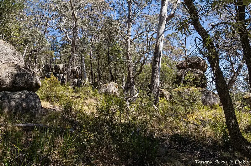
The track passes through subalpine woodland, open forest, heath and boulder fields. It is moderate except where you climb the rocks, with short steep hills, occasional steps, a rough track with many obstacles and limited signage. Grade 4 means some bushwalking experience is recommended. It is good for birds: expect honeyeaters, pardalotes, robins, treecreepers, rosellas and lorikeets, with wedge-tailed eagles often circling the tors.
Cathedral Rock itself is about 200 metres of stacked boulders, and the climb to its top is a Grade 5 scramble over rocks and across crevices that are slippery when wet. It sits on the separate 6 km Cathedral Rock track loop near Barokee. Round Mountain, beside the park, is the highest point of the New England Tablelands.
You can start at either end. You can leave a car at one campground and camp at the other before walking back, do a car shuffle for a one way day walk, or walk the full 20.8 km return in one day.
Getting there
For Barokee, turn off Waterfall Way onto Round Mountain Road 5 km west of Ebor and follow 8 km of narrow gravel road, then turn right into the campground. This road can turn boggy when it rains and needs a 4WD in wet weather. For Native Dog, take Guyra Road north for 10 km from Waterfall Way (3 km west of Ebor), then a short gravel road on the left. There is parking at both campgrounds.
Facilities
Barokee has 8 campsites and Native Dog has 6, both bookable online, with non flush toilets, wood barbecues and picnic tables. Neither has water, so carry all your drinking water. Native Dog also has the easy 1 km Warrigal track and a creek for paddling. Pets are not allowed in the park.
Before you go
The park sits high enough for winter nights to drop below freezing (as low as minus 7 degrees), and the weather can turn quickly in any season. Mobile reception is limited, so fill in a trip intention form before you leave. Check the Cathedral Rock National Park alerts before you go. Full details are on the NSW National Parks walk page.
Elevation
- Climb
- 90 m
- Descent
- 330 m
- Highest
- 1,562 m
- Lowest
- 1,262 m
Approximate, from a 30 m terrain model, so it can overstate the climb on cliff edge tracks.
Before you go
Tell your people where you are going
Set your route and return time in FriendsFindMe. If you do not check in, the people you trust are sent a text so they know to come looking for you.
Park and state forest boundaries: CAPAD 2024 © Commonwealth of Australia (DCCEEW), CC BY 4.0; © Forestry Corporation of NSW, CC BY 3.0 AU; © State of Queensland, CC BY 4.0; © State of Victoria (DEECA), CC BY 4.0
Walk data: © State of New South Wales (NSW National Parks and Wildlife Service), CC BY 4.0