
About this walk
This track follows the Grose River downstream through the Grose Wilderness in Blue Mountains National Park, from Burra Korain Flat near Mount Victoria to the Blue Gum Forest below Blackheath. This walk starts at the Burra Korain Flat campground, where Victoria Creek meets the Grose River, and ends near the track junctions at the Blue Gum Forest, where the river meets Govetts Creek. The stretch is about 8.8 km plus 500 metres to the signposted junction in the forest, and it is for experienced walkers only.
What it is like
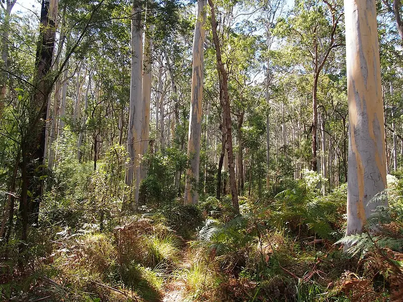
There is no road in. You reach Burra Korain Flat by walking down from the end of Victoria Falls Road past Victoria Falls lookout and the Grose Valley lookout, down a steep track that zigzags through the cliffs to the base of Victoria Falls, then 1.5 km along Victoria Creek. From the campground the track crosses the creek, then keeps to the south side of the Grose River for several kilometres, rising and dropping along steep slopes and crossing side creeks, before opening out onto wide river flats with old fireplace clearings. In places the track is rough and hard to see, signs are few and creeks are not bridged, so you need to navigate for yourself. Creek crossings can become impassable after rain.
The Blue Gum Forest is a tall stand of Deane's blue gum on the river flats. In 1931 a group of bushwalkers led by Myles Dunphy raised 130 pounds during the Depression to buy it and stop it being cleared, and it is now protected in the national park.
Camping and water
Burra Korain Flat has 12 unmarked tent sites and a toilet, with no fees and no bookings. Acacia Flat campground, near the Blue Gum Forest, has 30 sites and toilets; camping is free but booking carries a $6 fee. Neither has drinking water: boil creek water for at least 3 minutes. About 3.5 km downstream of Burra Korain the track meets the Pierces Pass to Blue Gum Forest track, which carries on to Acacia Flat. From there you can climb out to Perrys Lookdown (3.3 km, Grade 4, very steep, with many steps).
Before you go
There is no mobile reception below the Grose Valley lookout. Carry a personal locator beacon (the Blue Mountains Heritage Centre in Blackheath lends them free), a topographic map, compass and GPS, and fill in a trip intention form. Check the Burra Korain Flat alerts and the Blue Mountains National Park alerts before you go. The campground details are on the NSW National Parks Burra Korain Flat page.
Elevation
- Climb
- 430 m
- Descent
- 540 m
- Highest
- 801 m
- Lowest
- 590 m
Approximate, from a 30 m terrain model, so it can overstate the climb on cliff edge tracks.
Before you go
Tell your people where you are going
Set your route and return time in FriendsFindMe. If you do not check in, the people you trust are sent a text so they know to come looking for you.
Park and state forest boundaries: CAPAD 2024 © Commonwealth of Australia (DCCEEW), CC BY 4.0; © Forestry Corporation of NSW, CC BY 3.0 AU; © State of Queensland, CC BY 4.0; © State of Victoria (DEECA), CC BY 4.0
Walk data: © State of New South Wales (NSW National Parks and Wildlife Service), CC BY 4.0