
About this walk
The Cape Baily Track follows the sandstone clifftops on the Kurnell side of Kamay Botany Bay National Park, the southern headland of Botany Bay, where the crew of the Endeavour met local Aboriginal people in 1770. From the Cape Solander carpark it is 8 kilometres return, about 3 hours, Grade 2, which means a clearly signposted track that needs no bushwalking experience. You can also walk it one way, about 4 kilometres, and finish at Potter Point.
This walk runs the length of that coast, from Boat Harbour, west of Potter Point, north past the lighthouse to Cape Solander, so it carries on a little beyond the Potter Point finish.
What you see
The track winds through coastal heath, small sand dunes and freshwater wetlands, the hanging swamps that sit on top of the cliffs, with native orchids flowering in some seasons. Near the southern end is the Cape Baily Light, a small tower lit in 1950 and still working, with a lantern reused from an older 19th century lighthouse. The tower itself is not open. From May to October whales pass close to the cliffs on their migration, and dolphins, sea birds and lizards are often about. These months are the best time to go, when the weather is milder too.
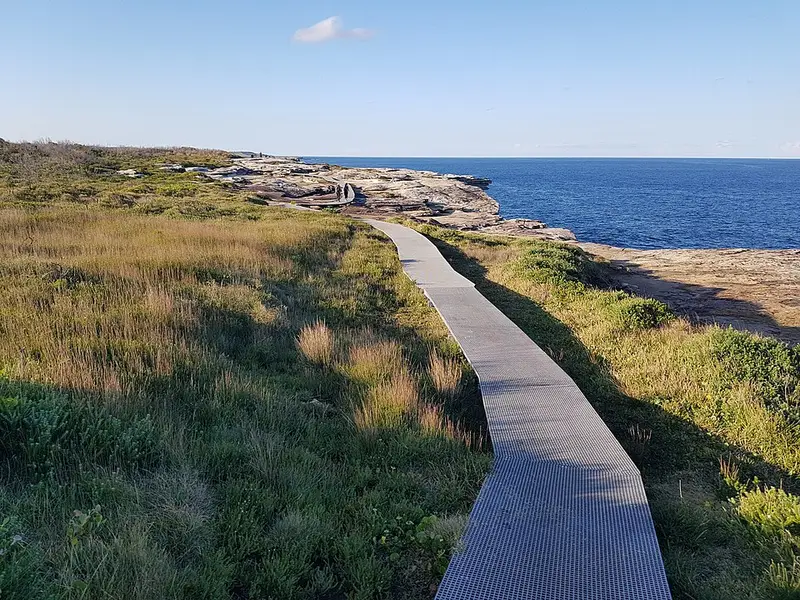
Underfoot it is a formed track that is mostly flat, with a few steps, natural sandstone and long sections of raised boardwalk. A recent upgrade added more than 520 metres of boardwalk along the clifftop, lifting the track off ground that used to be wet and boggy. It is not suitable for wheelchairs, prams or walking frames. The track is planned to become the northern gateway of the Great Southern Walk, a 67 kilometre route of several days from Sydney to the Illawarra.
Getting there and facilities
Drive along Captain Cook Drive towards Kurnell, turn left at the T intersection, then right into Cape Solander Drive and follow it past the visitor centre to the end. The roads are sealed and fine for any car. The carpark fills early on weekends and in whale season. If you only want to walk one way, you can be dropped off or picked up at the Potter Point carpark.
There are no toilets, drinking water or shade on the track, only a few informal seats, so carry water, a hat and sunscreen. The nearest toilets are at Commemoration Flat picnic area, about 5 minutes' drive from Cape Solander, and outside the Kurnell Visitor Centre. Park entry in the Kurnell area is $8 per vehicle per day, paid by coin at the machines or by card. The park is open 7am to 7.30pm.
Before you go
The clifftops are exposed, so stay away in strong or gale force winds. Wear a lifejacket if you fish from the rocks. Pets (other than certified assistance animals), bikes, camping and fires are not allowed. Check the Cape Baily walking track alerts before you go, and see the NSW National Parks Cape Baily page for the full details.
Elevation
- Climb
- 140 m
- Descent
- 130 m
- Highest
- 34 m
- Lowest
- 3 m
Approximate, from a 30 m terrain model, so it can overstate the climb on cliff edge tracks.
Before you go
Tell your people where you are going
Set your route and return time in FriendsFindMe. If you do not check in, the people you trust are sent a text so they know to come looking for you.
Park and state forest boundaries: CAPAD 2024 © Commonwealth of Australia (DCCEEW), CC BY 4.0; © Forestry Corporation of NSW, CC BY 3.0 AU; © State of Queensland, CC BY 4.0; © State of Victoria (DEECA), CC BY 4.0
Walk data: © State of New South Wales (NSW National Parks and Wildlife Service), CC BY 4.0