
About this walk
This is the northern end of the Coast Track in Royal National Park, Australia's oldest national park, on the southern edge of Sydney. This walk runs from Bundeena, at the top of the park, south along the cliffs past Wedding Cake Rock and Marley Beach to Wattamolla. The whole Coast Track runs 27 kilometres from Bundeena to Otford, is Grade 4 and takes 2 days. This stretch is the first part of its first day, which runs 17 kilometres from Bundeena to Garie Beach.
What you see
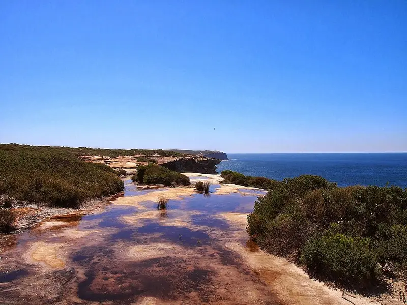
The track crosses coastal heath on sandstone cliff tops, with sweeping ocean views the whole way. About an hour south of Bundeena is Wedding Cake Rock, a block of white sandstone perched above the sea. Its colour comes from iron leaching out of the rock, which has left it soft, cracked and at very high risk of collapse, so it is fenced off: stay behind the fence and take your photos from a distance. Beyond it the track drops to Marley Beach, passes Little Marley Beach, and arrives at Wattamolla, where a lagoon sits behind the beach under a waterfall and cabbage tree palms shade the picnic area. Do not jump from the top of the waterfall into the lagoon: many people have been hurt doing it.
In the heath you may see swamp wallabies and plenty of birds, and in spring the wildflowers. May to October is humpback whale season, and the cliff tops make good lookouts.
Underfoot
The track to Wedding Cake Rock is rough and often steep and rocky, so wear sturdy shoes. None of the beaches in the park are patrolled and they can have strong rip currents.
Getting there and facilities
The track head is at the end of Beachcomber Avenue in Bundeena, where there is parking, a toilet and the last tap for refilling water bottles. Without a car, take the train to Cronulla and the ferry across Port Hacking to Bundeena, then walk about 1.5 kilometres to the start. Wattamolla has toilets, a picnic area and untreated water, which you must treat or boil before drinking, and a car park where the park's vehicle entry fee applies ($12 per vehicle per day when this was written). The park is open 7am to 8.30pm. Pets are not permitted, and recreational drones are banned.
If you are walking on past Wattamolla, the track continues south past Curracurrang Cove and Eagle Rock to Garie Beach, where the only campground on the track has to be booked in advance.
Before you go
Mobile reception is limited, so download the park maps in the NPWS app before you leave home, carry at least 2 litres of water each, and fill in a trip intention form. During a total fire ban the track to Wedding Cake Rock is closed. Check the Coast Track alerts and read the NSW National Parks Coast Track page before you go.
Elevation
- Climb
- 210 m
- Descent
- 240 m
- Highest
- 79 m
- Lowest
- 0 m
Approximate, from a 30 m terrain model, so it can overstate the climb on cliff edge tracks.
Before you go
Tell your people where you are going
Set your route and return time in FriendsFindMe. If you do not check in, the people you trust are sent a text so they know to come looking for you.
Park and state forest boundaries: CAPAD 2024 © Commonwealth of Australia (DCCEEW), CC BY 4.0; © Forestry Corporation of NSW, CC BY 3.0 AU; © State of Queensland, CC BY 4.0; © State of Victoria (DEECA), CC BY 4.0
Walk data: © State of New South Wales (NSW National Parks and Wildlife Service), CC BY 4.0