
About this walk
The Engadine Track is the old bush track that links Engadine, on the western edge of Royal National Park, with Audley, the park's historic picnic grounds on the Hacking River. This walk runs the length of it, from the Hacking River at Audley west to the bushland behind Engadine station. It is 5.8 kilometres one way, about 2.5 hours, and Grade 4 for its steepest sections.
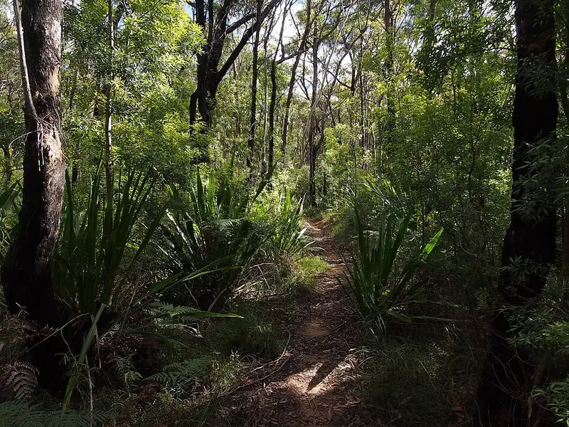
What it is like
From Engadine the track starts fairly flat through gum forest, crossing a few small creeks and a maze of service trails, so follow the signs for Audley at each junction. The middle of the walk is the hard part: a long, steep and rocky descent with wooden steps into the valley of Kangaroo Creek, then a big metal staircase back up the far side. Where Engadine Creek joins Kangaroo Creek there are rock pools that walkers use for a swim, but no facilities and little shade. Past the climb you get views over the valley, then rock steps take you down to the Hacking River near Robertsons Roundabout, a viewpoint circuit that starts from the same track, and on to Currawong Flat and the bridge across the river to Audley.
Getting there and facilities
The Engadine end is a short walk from Engadine station on the Illawarra line, which makes a one way walk easy to plan. At Audley the Royal National Park Visitor Centre (2 Lady Carrington Drive, open 8.30am to 4.30pm daily, closed Christmas Day, phone 02 9542 0648) has maps, park passes and walking advice, with the Audley Dance Hall cafe and Audley Boatshed, where you can hire a canoe, beside it. Currawong Flat picnic area has barbecues under the she oaks beside the river. If you drive into the park to Audley, the vehicle entry fee applies ($12 per vehicle per day when this was written). Royal National Park is open 7am to 8.30pm.
Before you go
Pets are not permitted in the park, and cyclists may ride only on trails marked on the NPWS cycling map. Mobile reception in the park is limited, so download the maps in the NPWS app before you leave. Carry your own water, since there are no facilities between the two ends. Check the Royal National Park alerts before you go.
Elevation
- Climb
- 290 m
- Descent
- 130 m
- Highest
- 212 m
- Lowest
- 13 m
Approximate, from a 30 m terrain model, so it can overstate the climb on cliff edge tracks.
Before you go
Tell your people where you are going
Set your route and return time in FriendsFindMe. If you do not check in, the people you trust are sent a text so they know to come looking for you.
Walks near Royal National Park
Park and state forest boundaries: CAPAD 2024 © Commonwealth of Australia (DCCEEW), CC BY 4.0; © Forestry Corporation of NSW, CC BY 3.0 AU; © State of Queensland, CC BY 4.0; © State of Victoria (DEECA), CC BY 4.0
Walk data: © State of New South Wales (NSW National Parks and Wildlife Service), CC BY 4.0