
About this walk
The Folly Point track leaves the Endrick River Fire Trail at Newhaven Gap, in the north of the Budawang wilderness in Morton National Park, and follows a long ridge south to Folly Point, a jumble of sandstone at the end of the ridge high above Hollands Gorge. This walk covers that whole spur, from the fire trail junction to the point. It is about 8 kilometres, and the Coast and Mountain Walkers club has looked after it since 1965.
What you see
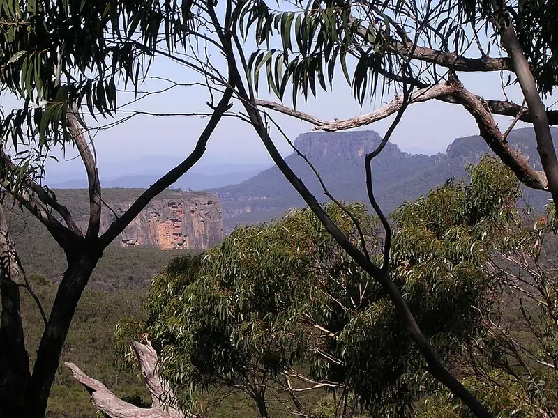
Folly Point has among the best views in the Budawangs: The Castle, Hollands Gorge, Mount Talaterang, Pigeon House Mountain Didthul, Byangee Walls, the Clyde Gorge, Mount Cole and Mount Bibbenluke. The 2019 and 2020 fires burnt the banksia and hakea that used to hide much of this, and there is a new outlook on the way out, Graeme Mitchell Lookout, looking south to Pigeon House and The Castle.
What it is like
The track is a narrow, winding footpad through banksia and hakea scrub that has been regrowing since the fires. It is mostly easy to follow, with the second half slower going. Beyond the point, Watsons Pass descends towards Hollands Gorge on an unmarked route with metal spikes in the rock and sections where packs must be passed down; that is for experienced navigators only.
Water and camping
There is a small stream beside a few tent spots at Folly Point, falling off the plateau in a series of small waterfalls with deep pools, but the flow can be meagre in dry weather. Carry enough water for the walk out. The Folly Point track is one of the routes walkers must keep to inside the former artillery impact area, and camping in the highly contaminated zone is allowed only at Sassafras and Link Road. Check the unexploded ordnance map before planning a night out here, never leave the track, and report anything that looks like ordnance to police on 000 without touching it.
Getting there
Most walkers start from the Sassafras entrance off Braidwood Road. There is a picnic area at a locked gate about 3 kilometres from the main road, then about 7 kilometres of fire trail to Newhaven Gap. Another approach is from the Nerriga entrance along the Red Ground and Endrick River fire trails. There are no facilities on the track.
Before you go
Pets are not allowed, groups camping overnight are limited to 12, and mobile reception is limited across the park. Long distance walkers should fill in a trip intention form and carry a personal locator beacon. Read the Budawang wilderness walking guidelines and check the Morton National Park alerts before you go.
Elevation
- Climb
- 340 m
- Descent
- 240 m
- Highest
- 794 m
- Lowest
- 651 m
Approximate, from a 30 m terrain model, so it can overstate the climb on cliff edge tracks.
Before you go
Tell your people where you are going
Set your route and return time in FriendsFindMe. If you do not check in, the people you trust are sent a text so they know to come looking for you.
Park and state forest boundaries: CAPAD 2024 © Commonwealth of Australia (DCCEEW), CC BY 4.0; © Forestry Corporation of NSW, CC BY 3.0 AU; © State of Queensland, CC BY 4.0; © State of Victoria (DEECA), CC BY 4.0
Walk data: © State of New South Wales (NSW National Parks and Wildlife Service), CC BY 4.0