
About this walk
This is the Light to Light Walk in Beowa National Park (called Ben Boyd National Park until 2022), the coastal track that links two lights south of Eden: Boyds Tower above Twofold Bay, and Green Cape Lighthouse, the southernmost lighthouse in NSW. It is 32 km one way over 3 days, and Grade 4, meaning you should have some bushwalking experience and be able to carry your camping gear.
Benjamin Boyd built his tower in 1847 from Pyrmont sandstone, hoping to use it as a lighthouse. The government never approved it, so whalers used it as a lookout until the 1920s. Green Cape Lighthouse, first lit in 1883, is also the tallest in NSW, and graves at its foot hold victims of the Ly-ee-Moon, wrecked below the cape in 1886.
The route
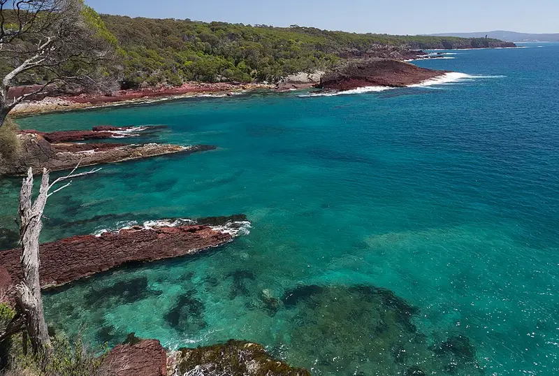
The three days are 9 km from Boyds Tower to Mowarry Point, 10 km to Hegartys Bay, then 13 km to Green Cape. You pass coastal tea tree and forest regrowing after the 2019 and 2020 fires, Leather Jacket Bay, Mowarry Beach, heath and rock shelves, Saltwater Beach, Bittangabee Bay and Pulpit Rock lookout. Watch for the eastern ground parrot in the heath and for whales offshore: September to early December is the best time to see them.
Saltwater, Woodburn and Bittangabee creeks may mean wet feet, and their depth changes with tides, swell and floods. Cross rock platforms only at low tide and keep off them in big seas: in rough weather take the old inland track from Bittangabee to Green Cape on the last day. None of the beaches are patrolled, and rips occur even in the sheltered bays.
Camping and water
Mowarry Point and Hegartys Bay campgrounds each have 10 hardwood tent platforms (5.4 by 3.6 metres, bring guy ropes) and toilets that do not flush. Platforms are booked per site, from $115 for 2 nights, with park entry and transfers extra. Water is limited: carry at least 5 litres, treat all tank water, and refill at Saltwater Creek and Bittangabee, which are more reliable than the small tanks at the walkers' camps.
Getting there
Boyds Tower is about 45 minutes south of Eden: take the Princes Highway south for 18 km, then Edrom Road. Green Cape is reached by the same turn, then 21 km of unsealed Green Cape Road. Park entry is $8 per vehicle per day south of Eden. Cars left overnight are at some risk, so consider booking a transfer instead.
Before you go
Mobile reception is limited. Fill in a trip intention form, and you can hire a personal locator beacon free from the NPWS Merimbula office. Summer days can reach the high 30s on an exposed track. Check the Light to Light local alerts and the Beowa National Park alerts before you go. The full trip details are on the NSW National Parks Light to Light page.
Elevation
- Climb
- 640 m
- Descent
- 650 m
- Highest
- 55 m
- Lowest
- 0 m
Approximate, from a 30 m terrain model, so it can overstate the climb on cliff edge tracks.
Before you go
Tell your people where you are going
Set your route and return time in FriendsFindMe. If you do not check in, the people you trust are sent a text so they know to come looking for you.
Park and state forest boundaries: CAPAD 2024 © Commonwealth of Australia (DCCEEW), CC BY 4.0; © Forestry Corporation of NSW, CC BY 3.0 AU; © State of Queensland, CC BY 4.0; © State of Victoria (DEECA), CC BY 4.0
Walk data: © State of New South Wales (NSW National Parks and Wildlife Service), CC BY 4.0