
About this walk
Minyon Falls drops about 100 metres into a palm shaded gorge in Nightcap National Park, in the hills between Lismore and Byron Bay. This walk is the track between the park's two picnic areas: it leaves Minyon Grass picnic area, goes down to the base of the falls and climbs back up the escarpment to finish beside Minyon Falls picnic area at the top. Joining the ends along Minyon Drive turns it into the Minyon Loop (7.5 km, about 4.5 hours). Minyon Grass to the base of the falls and back is a 4 km return walk of about 2 hours. The Minyon Falls walking track is 13 km return and 3 to 4 hours. See also the Nightcap and Whian Whian visitor guide.
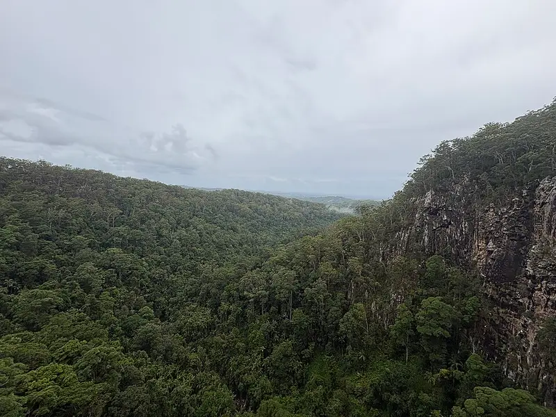
The track passes through rainforest, a large stand of old growth brushbox on the western side of Repentance Creek, and fern lined creeks, and runs along the escarpment edge. The pools at the base of the falls are a popular swim on hot days. The last stretch to the base is a scramble over large boulders that get very slippery when wet. Look for Albert's lyrebird, brush turkeys and peregrine falcons. The park is part of the Gondwana Rainforests of Australia World Heritage Area and is the traditional land of the Widjabul people of the Bundjalung Nation, for whom Minyon Falls is a significant place.
Underfoot
The track is Grade 3: a clearly signposted, formed track with some obstacles, short steep hills and many steps. Some bushwalking experience is recommended.
Getting there
From Bangalow, drive through Clunes and Rosebank, then take Repentance Creek Road, Upper Coopers Creek Road and Minyon Falls Road into the park, and follow the signs along Minyon Drive. Both picnic areas have car and bus parking, which fills on weekends and holidays. There is also a southern approach from Lismore along Nightcap Range Road, so check the alerts below for any road closures before choosing your route.
Facilities
Minyon Falls picnic area has picnic tables, non flush toilets and a lookout with step free access; do not go within 100 metres of the top of the falls. Minyon Grass picnic area is quieter, with tables and views of the falls. No drinking water is available in the park. The Boggy Creek walk links the top of the falls with Rummery Park campground in Whian Whian State Conservation Area. Pets and recreational drones are not permitted.
Before you go
Nightcap has the highest annual rainfall in NSW, so expect mist, mud and slippery rock, and pack insect repellent. The falls run hardest after wet weather and can be a trickle in dry spells. Check the track alerts before you go.
Elevation
- Climb
- 260 m
- Descent
- 330 m
- Highest
- 357 m
- Lowest
- 158 m
Approximate, from a 30 m terrain model, so it can overstate the climb on cliff edge tracks.
Before you go
Tell your people where you are going
Set your route and return time in FriendsFindMe. If you do not check in, the people you trust are sent a text so they know to come looking for you.
Walks near Repentance Creek
Park and state forest boundaries: CAPAD 2024 © Commonwealth of Australia (DCCEEW), CC BY 4.0; © Forestry Corporation of NSW, CC BY 3.0 AU; © State of Queensland, CC BY 4.0; © State of Victoria (DEECA), CC BY 4.0
Walk data: © State of New South Wales (NSW National Parks and Wildlife Service), CC BY 4.0