
About this walk
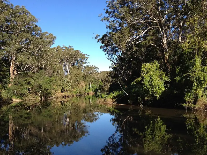
The Riverside walking track follows the southern bank of the Lane Cove River through Lane Cove National Park, a strip of bushland on both sides of the river in Sydney's north. It is 5 kilometres one way between De Burghs Bridge on Lane Cove Road and the weir near Delhi Road, taking 2 to 3 hours. This walk covers that same stretch, from De Burghs Bridge downstream to the Lane Cove Weir and Koonjeree picnic area, a short walk from Fullers Bridge.
What it is like
It is Grade 3: clearly signposted and needing no experience, but with short steep hills, plenty of steps and a formed path with some obstacles such as roots and rocks. Parts of the track wind above the water past small cliffs, and it crosses Porters Creek on a bridge built from sandstone cut nearby. Along the way you pass a string of riverside picnic areas, including Commandment Rock, a good place for lunch, and the sandstone Lane Cove Boatshed, where you can hire a rowboat or kayak. Near the weir a short boardwalk leads to a fenced river lookout.
Bring binoculars. Lorikeets, kookaburras, egrets and spoonbills live along the river, and you may see swamp wallabies and brush turkeys in the bush.
Making it a loop
The Great North Walk follows the northern bank of the same stretch of river, and the two tracks meet at the weir and at De Burghs Bridge. Walk out on one bank and back on the other for a greater challenge, a circuit of about 10 kilometres.
Getting there and facilities
Drive in from Delhi Road in West Chatswood or Lane Cove Road in Macquarie Park. For the eastern end, park along Riverside Drive near Koonjeree picnic area, which has toilets, tap water, barbecues and shelters. Several other picnic areas along the river have toilets, and there are car parks at points along the walk, so you can do it one way with a car at each end or shorten it. Buses run along Delhi Road to the Fullers Bridge stop.
Park entry is $8 per vehicle per day, paid at the machines or with the Park'nPay app. The park is open 9am to 7pm during daylight saving and 9am to 6pm the rest of the year. Organised groups of 30 or more need written approval first. If you want to stay, the park has campsites and cabins at Lane Cove Holiday Park.
Before you go
Pets are not allowed, other than certified assistance animals. Mobile reception is limited, so download the Emergency Plus app before you go, and take care near the river. Carry water, a hat and sunscreen. Check the Riverside walking track alerts and the Lane Cove National Park alerts before you go. The NSW National Parks Riverside walking track page has the full details.
Elevation
- Climb
- 70 m
- Descent
- 90 m
- Highest
- 38 m
- Lowest
- 9 m
Approximate, from a 30 m terrain model, so it can overstate the climb on cliff edge tracks.
Before you go
Tell your people where you are going
Set your route and return time in FriendsFindMe. If you do not check in, the people you trust are sent a text so they know to come looking for you.
Park and state forest boundaries: CAPAD 2024 © Commonwealth of Australia (DCCEEW), CC BY 4.0; © Forestry Corporation of NSW, CC BY 3.0 AU; © State of Queensland, CC BY 4.0; © State of Victoria (DEECA), CC BY 4.0
Walk data: © State of New South Wales (NSW National Parks and Wildlife Service), CC BY 4.0