
About this walk
This is the Fingal Bay to One Mile stretch of the Tomaree Coastal Walk, the 27 km coastal track through Tomaree National Park from Tomaree Head at Shoal Bay to Birubi Point at Anna Bay, near Port Stephens. It starts at the southern end of Fingal Bay, by Barry Park, and finishes behind One Mile Beach. The country between Barry Park and One Mile Beach is the most remote part of the whole walk.
The walk
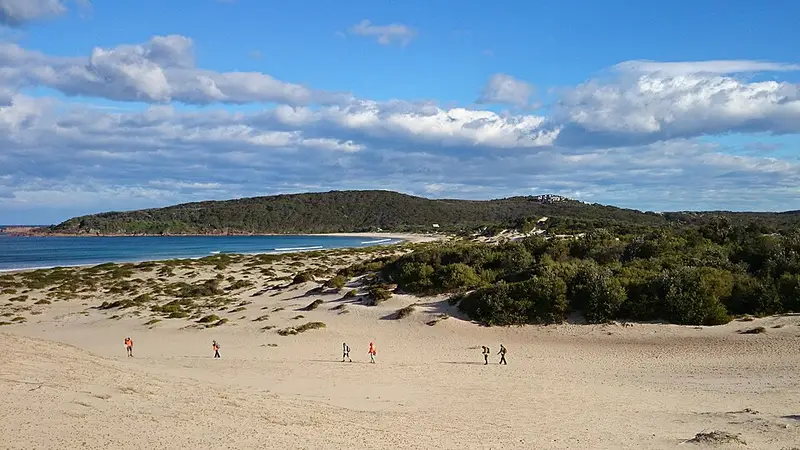
Barry Park has a lookout for whale watching, plus toilets and drinking water. From there the track heads south west into forest, which gives welcome shade on a hot day: melaleucas in the swampy hollows, and red bloodwoods and twisted smooth barked apples on the hillsides. In winter you pass clumps of gymea lilies, their single red flower spikes held metres above your head. Watch the sea for humpback whales migrating between May and November, and for dolphins and sea eagles.
Near the end, a 200 m side track leads down to Big Rocky, a bay named for its red volcanic rocks. At low tide its rock pools are worth the detour, and it is a popular spot for a picnic or fishing. The track then comes out at Samurai Beach. Samurai Beach is clothing optional, and 4WD vehicles are allowed on the sand. Climb over Middle Rock and follow the track away from the beach to One Mile, where the Port Stephens Koala Sanctuary is close by.
Practical details
The full walk is Grade 4, mostly because of its length; most of the ground is flat and gentle with some short, steep hills, sandy beaches and rock platforms. Check the tide times, because at high tide you may need to walk along the top of the beaches. There are no facilities between Barry Park and One Mile Beach, so fill your water bottles at Barry Park. Toilets and water are at One Mile Beach, and you can buy food at Fingal Bay and One Mile Beach.
Fingal Bay and One Mile are both on the bus network, so a bus or taxi can get you back to your car. The rest of the walk continues 9 km from One Mile past Boat Harbour and Fishermans Bay to Birubi Point. The whole route can be walked as a two day itinerary with a night at One Mile.
Pack for exposed coastline in summer storms or strong winter winds, and download the Tomaree National Park map in the NSW National Parks app. Check the Tomaree National Park alerts before you go.
Elevation
- Climb
- 130 m
- Descent
- 150 m
- Highest
- 60 m
- Lowest
- 2 m
Approximate, from a 30 m terrain model, so it can overstate the climb on cliff edge tracks.
Before you go
Tell your people where you are going
Set your route and return time in FriendsFindMe. If you do not check in, the people you trust are sent a text so they know to come looking for you.
Park and state forest boundaries: CAPAD 2024 © Commonwealth of Australia (DCCEEW), CC BY 4.0; © Forestry Corporation of NSW, CC BY 3.0 AU; © State of Queensland, CC BY 4.0; © State of Victoria (DEECA), CC BY 4.0
Walk data: © State of New South Wales (NSW National Parks and Wildlife Service), CC BY 4.0