
About this walk
The Belougerie Flats Circuit is a gentle loop on old fire trails, the wide unsealed management roads rangers use, starting from Camp Blackman in Warrumbungle National Park, near Coonabarabran. The route follows the Belougerie Flats Trail and Middle Belougerie Flats Trail east of the campground, across open flats that were cleared under an early grazing lease, with several creek fords on the eastern side near Belougery Spring.
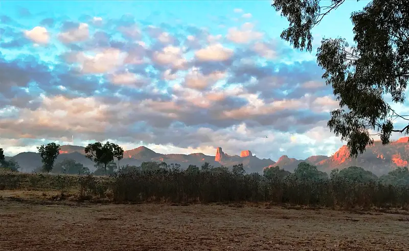
It is about 5.4 km and a little over an hour, mostly flat with a few short rises. The trail is wide, clear and well signposted, with a few eroded patches, and it is easy going on foot or by bike. Walk it anticlockwise for the best views of the volcanic peaks: the Grand High Tops, Bluff Mountain, Mount Exmouth and Belougery Split Rock, with Siding Spring Observatory on the range. Expect kangaroos, emus and plenty of birds, and give magpies a wide berth in nesting season. Snakes are about in warm weather.
Camp Blackman and the park
Camp Blackman is the park's main campground, with 107 bookable sites for tents, camper trailers and caravans, powered and unpowered sites, toilets, hot showers, barbecues and a public phone. Bring firewood, drinking water and cooking water. It gets busy in the spring and autumn school holidays, at Easter and on the October long weekend. Park entry is $8 per vehicle per day. The Warrumbungle Visitor Centre, a short drive south, has maps and park information.
Warrumbungle was Australia's first Dark Sky Park, so use suitable low lighting at camp. The park was badly burnt in the 2013 fires and its tracks and campgrounds have since been rebuilt. For a harder walk from the same area, the signposted Belougery Split Rock walking track climbs to the rock you can see from these flats.
Before you go
Phone coverage in the park is patchy, so carry water and a basic first aid kit even on a short loop. Check the Warrumbungle National Park alerts before you go.
Elevation
- Climb
- 70 m
- Descent
- 60 m
- Highest
- 527 m
- Lowest
- 465 m
Approximate, from a 30 m terrain model, so it can overstate the climb on cliff edge tracks.
Before you go
Tell your people where you are going
Set your route and return time in FriendsFindMe. If you do not check in, the people you trust are sent a text so they know to come looking for you.
Park and state forest boundaries: CAPAD 2024 © Commonwealth of Australia (DCCEEW), CC BY 4.0; © Forestry Corporation of NSW, CC BY 3.0 AU; © State of Queensland, CC BY 4.0; © State of Victoria (DEECA), CC BY 4.0
Walk data: © OpenStreetMap contributors, ODbL