
About this walk
The Bibbulmun Track is Western Australia's long distance walking trail, running about 1,000 kilometres from Kalamunda in the Perth Hills to Albany on the south coast. The Parks and Wildlife Service of the Department of Biodiversity, Conservation and Attractions manages the land, and the Bibbulmun Track Foundation publishes the guidebooks and runs the volunteer maintenance program.
The track is named for the Bibbulmun, a group of the Noongar people. It was proposed in 1972 and first opened in October 1979, from Kalamunda to Northcliffe. After a major realignment in the 1990s, with shelters, toilets and steps built by prison work crews and campsites and bridges by volunteer groups, the present alignment to Albany opened on 13 September 1998.
The country
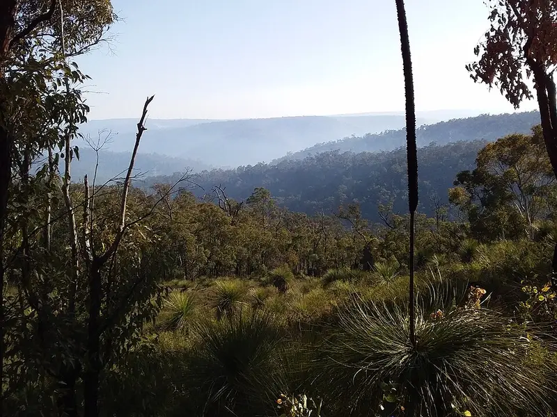
The track has nine sections: the Darling Range from Kalamunda to Dwellingup, then on to Collie, Balingup, Donnelly River Village (the halfway point), Pemberton, Northcliffe, Walpole, Denmark and Albany. The northern half winds through jarrah forest, granite outcrops and river valleys, including a crossing of Mundaring Weir. The south takes you through tall karri forest in Gloucester National Park, tingle forest around Walpole, and finally coastal heath and beaches, with inlet crossings at Irwin Inlet, Parry Inlet and Wilson Inlet. Yellow triangular markers carrying the Waugal, the rainbow serpent of the Noongar Dreaming, are set up to 500 metres apart and mark both directions.
Campsites and water
There are 53 campsites, including group sites and two on the Wellington Spur Trail, generally a day's walk apart: about 10 kilometres apart between Kalamunda and Brookton Highway, and 12 to 25 kilometres further south. Each has a three sided shelter, a pit toilet, a rainwater tank, picnic tables and tent sites. There are no bookings, so carry a tent in case a shelter is full, and treat all tank water. Mapped creeks are mostly seasonal. Nine towns along the way sell food. The track is free to walk; groups of eight or more staying overnight should lodge a group notification.
When to go and rules
The cooler months, roughly April to early November, are best, with wildflowers peaking in September and October. Long walks are strongly discouraged from December to early March because of heat that can reach the mid 40s and extreme bushfire risk. Campfire bans usually run from November to at least March, and every campsite south and east of the Shannon River, from Mt Chance to Albany, is a no fire site. An end to end walk takes most people six to eight weeks. The track is for walkers only: no bikes, horses or pack animals. Dogs are banned from national parks, nature reserves and drinking water catchments that cover much of it, and fox baits are laid in some areas.
Before you go
Mobile coverage is patchy, best with Telstra and mostly near towns and on some hilltops; the Foundation hires out personal locator beacons and has a trip intention form. Read the Foundation's track conditions page for diversions and burns, check the Bibbulmun Track filter on the DBCA Park Alerts site, and use the Section by Section guide to plan each stage.
Elevation
- Climb
- 19,850 m
- Descent
- 20,150 m
- Highest
- 575 m
- Lowest
- 1 m
Approximate, from a 30 m terrain model, so it can overstate the climb on cliff edge tracks.
Before you go
Tell your people where you are going
Set your route and return time in FriendsFindMe. If you do not check in, the people you trust are sent a text so they know to come looking for you.
Park and state forest boundaries: CAPAD 2024 © Commonwealth of Australia (DCCEEW), CC BY 4.0; © Forestry Corporation of NSW, CC BY 3.0 AU; © State of Queensland, CC BY 4.0; © State of Victoria (DEECA), CC BY 4.0
Walk data: © OpenStreetMap contributors, ODbL