
About this walk
This section of the Bicentennial National Trail runs north from Wallerawang, near Lithgow, through Gardens of Stone National Park and into the Capertee Valley, finishing on Upper Nile Road beyond the village of Glen Alice. The whole trail covers 5,330 kilometres from Cooktown in Queensland to Healesville in Victoria. Wallerawang divides the trail's Section 10, to the south, from its Section 9, which runs north to Aberdeen in the Upper Hunter.
The route
The trail leaves Wallerawang on town streets and Pipers Flat Road, follows Brays Lane through Lidsdale, then Wolgan Road. It turns off onto an unsealed track and the Crown Creek fire trail: 8.2 kilometres one way, about 5 hours, graded medium, for horse riders and mountain bikers. It starts as an unmarked trail heading west off Wolgan Road, opposite Blackfellows Hand trail, past Angus Place. The route passes through Baal Bone Gap, then follows Crown Station Road to Glen Davis Road, Glen Alice Road and Upper Nile Road in the valley.
Gardens of Stone
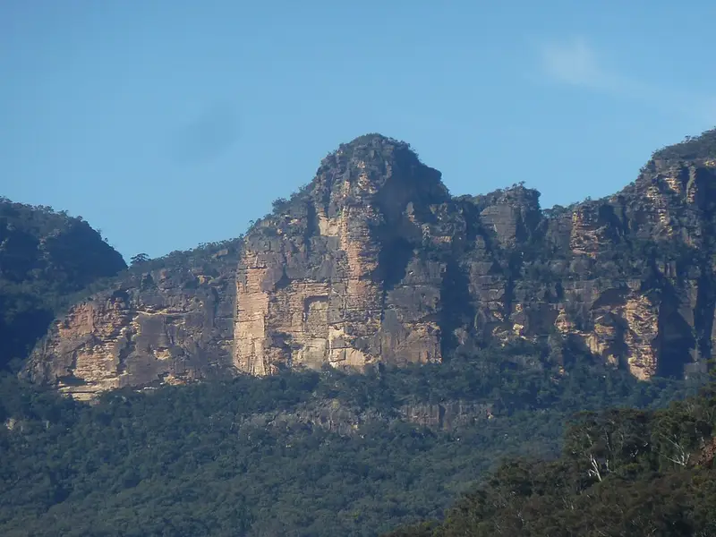
Gardens of Stone National Park is part of the Greater Blue Mountains World Heritage Area, known for rock pagodas, sandstone cliffs and canyons, and views to the mesa of Pantoneys Crown. Baal Bone Gap is the highlight of the park, and the road there may become impassable in heavy rain. There are no facilities on the Crown Creek trail, so bring everything you need, including water. Carry the Cullen Bullen and Ben Bullen topographic maps and a compass or GPS. Pets are not allowed in the park, and mobile coverage is limited.
When to go
Spring and autumn are the most pleasant times to ride. Summer averages run from 8 to 25 degrees and winter from 0 to 9. The trail's Section 9 is rated moderate. Spring, early summer and autumn are recommended; avoid winter, and midsummer after a dry spell. Horse riders and cyclists must give way to walkers, and cyclists to horses.
Before you go
The trail's maps are sold to members only, and its red and yellow striped triangle markers are not enough to navigate by. Camping on travelling stock reserves needs a permit from Local Land Services. Check the Crown Creek fire trail alerts and Gardens of Stone National Park alerts before you go, and read the National Trail section overviews.
Elevation
- Climb
- 750 m
- Descent
- 1,250 m
- Highest
- 1,068 m
- Lowest
- 278 m
Approximate, from a 30 m terrain model, so it can overstate the climb on cliff edge tracks.
Before you go
Tell your people where you are going
Set your route and return time in FriendsFindMe. If you do not check in, the people you trust are sent a text so they know to come looking for you.
Park and state forest boundaries: CAPAD 2024 © Commonwealth of Australia (DCCEEW), CC BY 4.0; © Forestry Corporation of NSW, CC BY 3.0 AU; © State of Queensland, CC BY 4.0; © State of Victoria (DEECA), CC BY 4.0
Walk data: © OpenStreetMap contributors, ODbL