
About this walk
The Bigurda Trail runs along the sandstone sea cliffs of Kalbarri National Park, south of the Kalbarri townsite on the Western Australian coast. It is 8 km one way between Eagle Gorge in the north and the Natural Bridge in the south, taking 3 to 5 hours. The suggested direction is north to south: get dropped at Eagle Gorge and walk south, finishing at Natural Bridge, which has toilets.
What you see
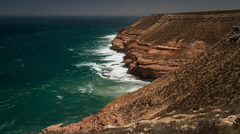
The track stays close to the cliff edge for its whole length. Along this coast wind and waves have cut the layered Tumblagooda Sandstone into cliffs more than 100 metres high, and the trail passes the lookouts at Shell House and Grandstand Rock Gorge and at Island Rock, a lone sea stack that was once part of the shore. At Natural Bridge the crumbling cliffs have left precarious rock formations, seen from two fenced lookouts, and you can watch for whales and dolphins offshore. At Eagle Gorge a short, steep switchback track (1 km return) drops over sandstone terraces to a beach. The coast is best in the late afternoon, when the low sun lights up the cliffs, and the park's wildflowers are at their best in spring.
Parts of the coastal trails are rocky and sandy, with loose and uneven ground. Keep well back from the cliff edges. The southernmost stretch, between Natural Bridge and Island Rock, is a separate sealed path and boardwalk of about 1.8 km that suits prams and wheelchairs, so you can walk just that part if a full day is too much.
Facilities and fees
Natural Bridge has a sealed car park and accessible toilets and picnic shelter. Eagle Gorge, Shell House and Island Rock have parking but no toilets. There is no drinking water anywhere in the park, so carry all you need. Park entry fees apply, $17 per standard vehicle, or use a WA park pass. Dogs and other pets are not allowed, and 1080 fox and cat baits are laid in the area.
Before you go
Summer heat in Kalbarri can be extreme. Walk between May and October, start early, and carry about 1 litre of water per person for every hour of walking, along with a hat and sturdy shoes. A personal locator beacon is worth carrying. Check Park Alerts WA before you go, and see the Kalbarri National Park page for trail and site details.
Elevation
- Climb
- 90 m
- Descent
- 110 m
- Highest
- 93 m
- Lowest
- 48 m
Approximate, from a 30 m terrain model, so it can overstate the climb on cliff edge tracks.
Before you go
Tell your people where you are going
Set your route and return time in FriendsFindMe. If you do not check in, the people you trust are sent a text so they know to come looking for you.
Park and state forest boundaries: CAPAD 2024 © Commonwealth of Australia (DCCEEW), CC BY 4.0; © Forestry Corporation of NSW, CC BY 3.0 AU; © State of Queensland, CC BY 4.0; © State of Victoria (DEECA), CC BY 4.0
Walk data: © OpenStreetMap contributors, ODbL