
About this walk
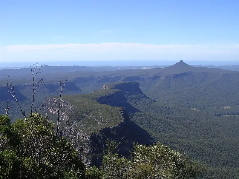
Byangee Mountain is the long cliff ringed block east of The Castle in the Budawangs, inland from Milton on the NSW South Coast. Its cliffs are known as Byangee Walls. The walk to it starts at Long Gully campground beside the Yadboro River, the same start as The Castle walk. This walk runs from the campground up the fire trail (the wide gravel roads rangers use) past the base of The Castle and Cathedral Cave to Castle Gap, the saddle between The Castle and Byangee, and on along the northern side of Byangee. It stops roughly where the climb up the walls begins, short of the summit.
The route
A dirt road runs from the car park to a river crossing that you can usually make with dry feet unless there has been heavy rain. A 4WD track then climbs steadily to the foot of The Castle and swings along beneath its cliffs towards the saddle, with a short optional detour to caves. From the saddle a track follows the northern base of Byangee, then climbs the cliff on a route marked by rock cairns. It steepens to a section where a fixed rope and a log step take you through a tight gap, eases, then passes through a rock chimney before a short walk to the summit cairn. The views take in The Castle, Pigeon House Mountain (Didthul) and the Clyde River valley. The full return trip to the summit is about 15 km and 8 hours, rated very hard. The scrambling is steep and exposed, so it suits experienced walkers who can navigate. The rope's condition can change over time, and there can be snakes in the tall scrub on top.
Getting there and camping
From Milton, follow the signs towards Pigeon House Mountain (Didthul), but stay on Yadboro Road instead of turning onto Pigeon House Road. Cross the Clyde River, join the Western Distributor and turn right onto Long Gully Road. These unsealed roads need a 4WD, are dry weather access only and can turn boggy in rain, and long vehicles cannot reach the campground.
Long Gully campground is in Budawang National Park, on a grassy flat with 7 unmarked sites, pit toilets and picnic tables. There is no camping fee but a $6 booking fee applies. No drinking water is provided, so bring your own or boil river water, and bring your own firewood. The Budawangs are a declared wilderness, with limits on group sizes, firewood and where you can camp.
Before you go
Check the Long Gully campground alerts before you go. The parks here may close in poor weather or high fire danger. For track questions, the NPWS Ulladulla office is on 02 4454 9500, and the Long Gully campground page has the booking details.
Elevation
- Climb
- 630 m
- Descent
- 200 m
- Highest
- 520 m
- Lowest
- 89 m
Approximate, from a 30 m terrain model, so it can overstate the climb on cliff edge tracks.
Before you go
Tell your people where you are going
Set your route and return time in FriendsFindMe. If you do not check in, the people you trust are sent a text so they know to come looking for you.
Park and state forest boundaries: CAPAD 2024 © Commonwealth of Australia (DCCEEW), CC BY 4.0; © Forestry Corporation of NSW, CC BY 3.0 AU; © State of Queensland, CC BY 4.0; © State of Victoria (DEECA), CC BY 4.0
Walk data: © OpenStreetMap contributors, ODbL