
About this walk
Carrolls Creek Walk is a long one way route on fire trails, the wide unsealed management roads rangers use, through the eastern and southern parts of Bald Rock National Park, north of Tenterfield. The route leaves Bald Rock Road at a gate on the Carrolls Creek Fire Trail, about a kilometre in from Mount Lindesay Road, follows that trail south, crosses a creek at a ford, then swings west and north on the Airstrip and Border fire trails to finish at a gate beside the Bald Rock campground and picnic area. These trails are for walkers and cyclists, not cars, and two short sections cross concrete bridges.
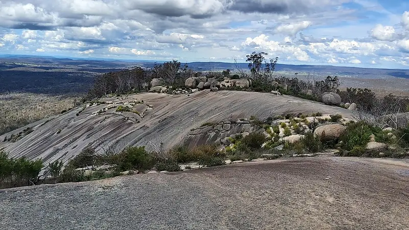
Because it ends at the main visitor area, the walk links with the park's signposted tracks: the Border walk loop to the Queensland border, the Bungoona walk and Bald Rock Summit walk up the dome, and the Little Bald Rock walking track. Bald Rock itself is the largest granite dome of its kind in Australia, about 750 metres long and 500 metres wide, and the park's granite country is known for boronia, banksia and other wildflowers in spring and golden wattle in late July. Look for grey kangaroos, swamp wallabies and red necked wallabies around dawn and dusk.
Getting there and facilities
Bald Rock Road leaves the sealed Mount Lindesay Road 29 km north of Tenterfield and is sealed to the visitor area. The campground has 13 bookable sites, toilets, drinking water, barbecues and picnic tables, so it makes a sensible base, and if you walk it in reverse from the campground you can fill your bottles before setting out; either way you need a car shuffle or a walk back along Bald Rock Road. Park entry is $8 per vehicle per day, paid by self registration with the correct change. Pets are not allowed in the park.
Before you go
This is a long day on fire trails with no facilities along the way. Carry all your water, and allow for the ford being deeper after rain. Mobile reception in the park is limited, and NPWS lends personal locator beacons free from its Tenterfield office. Check the Bald Rock National Park alerts before you go, and the park page for its walks and maps.
Elevation
- Climb
- 330 m
- Descent
- 260 m
- Highest
- 1,205 m
- Lowest
- 967 m
Approximate, from a 30 m terrain model, so it can overstate the climb on cliff edge tracks.
Before you go
Tell your people where you are going
Set your route and return time in FriendsFindMe. If you do not check in, the people you trust are sent a text so they know to come looking for you.
Park and state forest boundaries: CAPAD 2024 © Commonwealth of Australia (DCCEEW), CC BY 4.0; © Forestry Corporation of NSW, CC BY 3.0 AU; © State of Queensland, CC BY 4.0; © State of Victoria (DEECA), CC BY 4.0
Walk data: © OpenStreetMap contributors, ODbL