
About this walk
The Minyirr Trail is the main walking track through Minyirr Park in Broome, the coastal bushland between Gubinge Road and Cable Beach. Minyirr Park is part of the Yawuru Minyirr Buru Conservation Park, which the Yawuru Traditional Owners manage jointly with the Shire of Broome and the Department of Biodiversity, Conservation and Attractions (DBCA). It is a living cultural landscape and a place of great significance to Yawuru people.
The Minyirr Trail runs north to south between Minyirr Park Base Camp and the Broome Surf Life Saving Club. This walk runs from the Cable Beach end near the surf club south through the park to near Gantheaume Point Road, toward the southern end of Cable Beach.
What you walk through
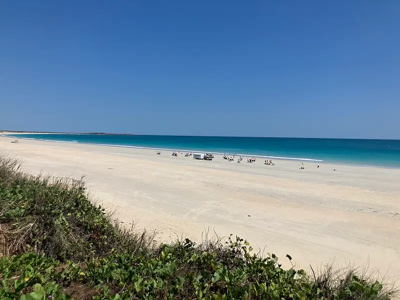
The trail crosses bundurr bundurr (pindan country, the red sandy soil Broome is known for) and niyamarri (sand dune country), and passes through pockets of mayingan manyja balu, monsoonal vine thicket that is rich in seasonal bush foods and culturally important to Yawuru people. Seven shorter nagula (saltwater) trails branch off it to Walmanyjun (Cable Beach), so you can make a short walk to the beach or link several sections into a longer one. The longest of them, the Birndany (stingray) Trail, climbs a large staircase over the dunes to a viewing platform for sunset over Cable Beach. The park's whole trail network is about 22 km.
All the Minyirr Park trails are Class 3: suitable for most ages and fitness levels, with natural surfaces, sandy sections, short steep hills and natural steps.
Rules
Stay on the marked trails and keep off the sensitive dunes and vegetation. Dogs must be on a leash and you must pick up after them. Cycling is allowed on the trails but not over the dunes to the beach, and riders must slow down and give way to walkers.
Before you go
There is no drinking water along the trails. Kimberley temperatures can pass 40°C, so drink about a litre per person per hour, walk in the cooler parts of the day, and wear a hat and long, loose sleeves. Tropical cyclones occur between November and April. If you go down to the beach, remember the tide range here can reach 9 to 10 metres, Irukandji and box jellyfish are most often reported from November to June, and this is crocodile country.
Gantheaume Point (Minyirr), with its red pindan cliffs and dinosaur footprints, is just beyond the southern end of Cable Beach. Check DBCA park alerts before you go, and see the Yawuru Minyirr Buru Conservation Park page for the other trails in the park.
Elevation
- Climb
- 30 m
- Descent
- 20 m
- Highest
- 25 m
- Lowest
- 12 m
Approximate, from a 30 m terrain model, so it can overstate the climb on cliff edge tracks.
Before you go
Tell your people where you are going
Set your route and return time in FriendsFindMe. If you do not check in, the people you trust are sent a text so they know to come looking for you.
Walk data: © OpenStreetMap contributors, ODbL