
About this walk
Munyunga waraga dhugan means "white bellied sea eagle's home camp" in the Dhurga language of the Wreck Bay Aboriginal people. It is a loop walk from the Murrays Beach car park in Booderee National Park at Jervis Bay, in the Jervis Bay Territory, and is also known as Murrays Trail. It is an ideal introduction to the park, a 5.4 km loop, about 2.5 hours, Grade 2.
What you see
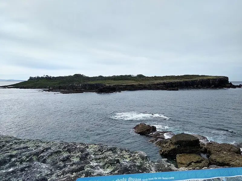
The walk is a self guided tour of Booderee's plants, animals, culture and history, told through 14 signs along the way. Short side tracks lead to Murrays Beach and to the lookout at Governors Head, where you look across Jervis Bay and out to Bowen Island, home to the park's breeding colony of little penguins. From the headland you may also see sea birds, seals, dolphins and, in season, whales. June and early July are the time for the winter whale migration, and on the southward journey in spring, mothers and calves sometimes come close into the sheltered bays. If you start early you might see the endangered eastern bristlebird.
It is a formed track with gentle hills, occasional steps and a short bridge, and about 120 metres of climbing in total. Not all the cliffs are fenced, so keep to the marked track.
Nearby walks
From the same car park, Murrays Beach is 300 m away (about 5 minutes) and Governors Head lookout 1.1 km (about 20 minutes), both Grade 2. At low tide you can walk to the boat ramp and across the rock platform to Murrays Beach, or turn the other way to Hole in the Wall (1.1 km one way) and on to Green Patch (4 km one way, about 1.5 hours). Everything on the rock platforms, including shellfish, seaweed, octopus and crabs, is protected.
Getting there and facilities
Booderee is on the NSW south coast between Nowra and Ulladulla, about three hours' drive from Sydney or Canberra. There is a toilet at the car park. You need a park pass to drive in: a one day vehicle pass is $20 ($10 concession), bought online or at the visitor centre. Walkers and cyclists entering on foot or by bike do not need one.
Before you go
Mobile and internet coverage in the park is very limited, so download maps beforehand. The visitor centre is on 1800 357 823, and in an emergency call 000 (or 112 from a mobile). Spiders, snakes and ticks live in the park; carry water and a first aid kit. Average temperatures range from 9 to 15°C in July to 17 to 24°C in January. Check the Booderee news page for closures and the Murrays Beach walks page before you go.
Elevation
- Climb
- 70 m
- Descent
- 90 m
- Highest
- 75 m
- Lowest
- 9 m
Approximate, from a 30 m terrain model, so it can overstate the climb on cliff edge tracks.
Before you go
Tell your people where you are going
Set your route and return time in FriendsFindMe. If you do not check in, the people you trust are sent a text so they know to come looking for you.
Park and state forest boundaries: CAPAD 2024 © Commonwealth of Australia (DCCEEW), CC BY 4.0; © Forestry Corporation of NSW, CC BY 3.0 AU; © State of Queensland, CC BY 4.0; © State of Victoria (DEECA), CC BY 4.0
Walk data: © OpenStreetMap contributors, ODbL