
About this walk
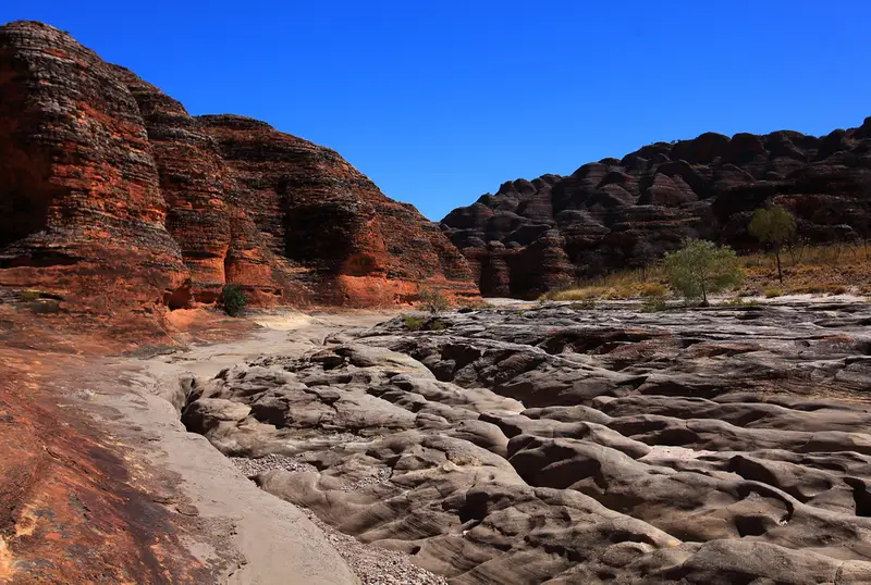
This walk heads north from the Piccaninny car park, at the southern end of the Bungle Bungle Range in Purnululu National Park, up the bed of Piccaninny Creek and into Piccaninny Gorge. It is the route of the Piccaninny Gorge Trek, which exceeds standard walk trail classification and suits only extremely experienced hikers. This walk runs about 15 km up the creek, past The Elbow (10 km from the car park, 4 to 5 hours) and roughly as far as Black Rock Pool and the Base Camp area beyond it. Purnululu is World Heritage listed and is the country of the Gija and Jaru people.
What it is like
There is no formed track, no markers and no signs. You follow an uneven, stony and sandy creek bed through the southern end of the range, home to its banded beehive domes, then into the gorge, where you climb over and around big boulders, pass steep, narrow edges and sudden drops, and may need to wade through pools of very cold water. Rockfalls can happen without warning. From Base Camp, side gorges called the Fingers run off the main gorge, 1 to 4 km each way. The minimum return trip to The Elbow is 20 km, and more than 40 km if you explore all the Fingers.
Rules and bookings
The trek is open from May to September, weather and road access permitting, and can close without notice. Bookings are essential, numbers are limited, and you pay trek camping fees online. You must register at the Purnululu Visitor Centre during office hours before you start (the day before is suggested) and deregister before 4pm on your return date, or a police search may begin. An in date, AMSA registered 406 MHz personal locator beacon is compulsory; satellite phones and trackers do not count. Beacons can be hired at the visitor centre for a $20 fee and a $200 refundable deposit. There is no mobile reception in the gorge.
There are no toilets, bins or camping facilities. You may camp in suitable spots near The Elbow and along the gorge, but not near Black Rock Pool or any water source, and never under the gorge walls. Black Rock Pool is the only reliable water, it is not drinkable untreated, and swimming, soap and washing up are banned there. Fires are not permitted; bring a fuel stove.
Getting there
The park is reached by the Spring Creek Track, 53 km of unsealed, corrugated road with creek crossings from the Great Northern Highway, open to high clearance 4WD vehicles only and taking 1.5 to 3 hours. There is no fuel in the park. The Piccaninny car park is 27 km (about 45 minutes) from the visitor centre and has shaded picnic tables and pit toilets.
Before you go
Temperatures can range from below freezing at night to over 40°C by day. Drink a litre per person per hour and walk in the cool of the morning. If you want a taste of the creek without the trek, the Creek Lookout Trail in Piccaninny Gorge (2.8 km return, over an uneven, eroded creek bed) gives views down Piccaninny Creek toward the domes, and the 1.4 km Domes walk is nearby in the southern end of the park. Check park alerts and read the Piccaninny Creek Area page and its fact sheet before you book.
Elevation
- Climb
- 900 m
- Descent
- 650 m
- Highest
- 487 m
- Lowest
- 244 m
Approximate, from a 30 m terrain model, so it can overstate the climb on cliff edge tracks.
Before you go
Tell your people where you are going
Set your route and return time in FriendsFindMe. If you do not check in, the people you trust are sent a text so they know to come looking for you.
Park and state forest boundaries: CAPAD 2024 © Commonwealth of Australia (DCCEEW), CC BY 4.0; © Forestry Corporation of NSW, CC BY 3.0 AU; © State of Queensland, CC BY 4.0; © State of Victoria (DEECA), CC BY 4.0
Walk data: © OpenStreetMap contributors, ODbL