
About this walk
Wardun Beelier Bidi, also called the Coast to River Trail, links the Indian Ocean at Cottesloe with the Swan River at Mosman Park and Peppermint Grove, joining up the bushland reserves of Perth's western suburbs. In Noongar, Wardun is the ocean and Beelier the river. It is the southernmost trail in the Whadjuk Trails network run by the western suburbs councils (WESROC), and the whole loop is 17.4 km, starting and finishing at Grant Marine Park in Cottesloe and taking up to 6 hours.
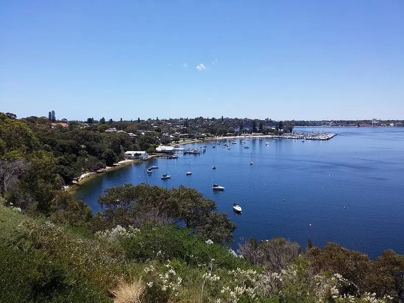
This walk covers about half of that loop: the Mosman Park and Peppermint Grove stretch. It starts near the coast in Mosman Park, crosses through the suburb's bushland to the river near Minim Cove, then follows the Swan River north past Chidley Point and Mosman Bay towards Keanes Point and Peppermint Grove. The Cottesloe beachfront half is not part of it.
What you see
Buckland Hill is one of the highest points near the Perth coast, used by Willem de Vlamingh as a lookout in 1696 and home to the Leighton Battery gun emplacements and tunnels during World War II. On the coast, Mudurup Rocks is a registered Noongar ceremonial site of mythological significance, looking out towards Wadjemup (Rottnest Island). Point Roe Park has a boardwalk among quandong trees, Chidley Point Reserve has Parrot Bush shrubland that feeds Carnaby's black cockatoos, and Bay View Park looks across Mosman Bay to the Point Walter sand bar. Watch for ospreys over the river and rainbow bee eaters from October. Wildflowers are best from July to November.
Underfoot and getting around
Most of the trail is paved path, with a short unsealed section through bushland in Peppermint Grove and a few steps north of Leake Street where cyclists may need to dismount. Triangular markers set into footpaths and bollards, and signs with a weedy sea dragon, show the way. The trail is free, dog friendly (dogs on a leash) and mostly suitable for bikes and wheelchairs, and many access points let you walk it in pieces. Mosman Park and Victoria Street train stations are close to the route. Keanes Point has a café, playground, toilets and parking, and Chidley Point Reserve has barbecues and toilets.
Before you go
Summer days are hot and much of the route is exposed, so bring water, a hat and sunscreen. Check the Whadjuk Walking Trails page for the trail map, wheelchair route and any notices before you go, and see Trails WA for more detail.
Elevation
- Climb
- 150 m
- Descent
- 150 m
- Highest
- 58 m
- Lowest
- 4 m
Approximate, from a 30 m terrain model, so it can overstate the climb on cliff edge tracks.
Before you go
Tell your people where you are going
Set your route and return time in FriendsFindMe. If you do not check in, the people you trust are sent a text so they know to come looking for you.
Walk data: © OpenStreetMap contributors, ODbL