
About this walk
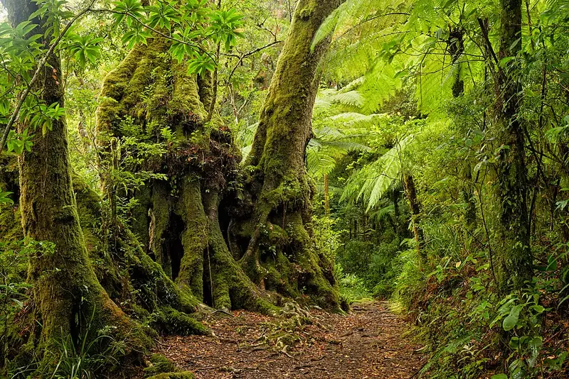
The Border Track is the long rainforest walk across Lamington National Park, linking the park's two sections: Binna Burra in the east and Green Mountains (O'Reilly) in the west. It is the backbone of the park's track system, because most of Lamington's other walks branch off it, and it is also the first day of the 54 km Gold Coast Hinterland Great Walk. This walk runs from the Binna Burra upper day use area to the Green Mountains day use area. It is 21.4 km one way, about 7 hours, Grade 4, meaning you should have some bushwalking experience.
What you see
The track keeps close to the rim of the old Tweed volcano, along the Queensland and New South Wales border. As it climbs it moves from warm and cool subtropical rainforest into temperate rainforest, crossing clear mountain streams and running along ridges. On a clear day the lookouts take in the Limpinwood Valley, Wollumbin (Mount Warning), the Nightcap Range and the Tweed Range. A short, steep side track (600 m return) leads to Beereenbano and Merino lookouts over the Tweed and Limpinwood valleys. In winter you are likely to hear the ringing call of the Albert's lyrebird. Part of the track passes through forest damaged by a severe storm in 1983.
There is no shortcut from either end: other tracks may look shorter but end up longer, so stay on the Border Track. Start at sunrise and arrange a pickup at the far end, or stay the night there. Only the first 700 m from Green Mountains is suitable for wheelchairs, with help.
Getting there and facilities
There is no public transport, and taxis and ride share drivers can be hard to get at the park. The Binna Burra upper day use area is at the end of Binna Burra Road, 3.5 km from the park entrance, reached via Nerang and Beechmont; the final stretch of road is very narrow and winding. Green Mountains is at the end of Lamington National Park Road, 36 km of winding, often narrow bitumen from Canungra that takes at least 50 minutes and is unsuitable for vehicles longer than 6 m or towing. Both trailheads have flush toilets, picnic tables and free electric barbecues. There is no fuel on the plateau, and dogs are not allowed in the park.
Before you go
Lamington averages about 5°C cooler than Brisbane and can drop below 0°C in winter. Most rain falls from November to March, and winter brings clearer views and fewer leeches. Mobile coverage is unreliable, though you can sometimes get a signal near lookouts. Check the Queensland park alerts and the Border Track page before you go.
Elevation
- Climb
- 740 m
- Descent
- 620 m
- Highest
- 1,194 m
- Lowest
- 814 m
Approximate, from a 30 m terrain model, so it can overstate the climb on cliff edge tracks.
Before you go
Tell your people where you are going
Set your route and return time in FriendsFindMe. If you do not check in, the people you trust are sent a text so they know to come looking for you.
Park and state forest boundaries: CAPAD 2024 © Commonwealth of Australia (DCCEEW), CC BY 4.0; © Forestry Corporation of NSW, CC BY 3.0 AU; © State of Queensland, CC BY 4.0; © State of Victoria (DEECA), CC BY 4.0
Walk data: Queensland Parks and Wildlife Service access © The State of Queensland 2025, CC BY 4.0