
About this walk
Manjal Jimalji is the Eastern Kuku Yalanji name for the rock known locally as Devils Thumb, a culturally significant site that holds the story of fire creation. The trail climbs to it from the Whyanbeel Valley, about 17 kilometres north of Mossman, in the Mossman Gorge section of Daintree National Park (CYPAL). It is a 10.6 kilometre return walk, Grade 4; allow 8 hours. This walk runs one way from the parking area to the lookout, including the 700 metre approach walk.
The route
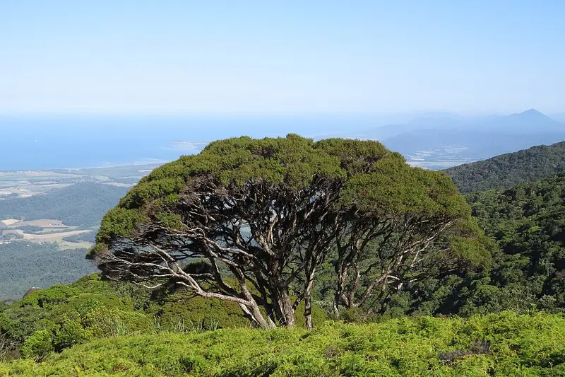
From the parking area, follow orange markers and signs for 700 metres to the start of the trail at Little Falls Creek. Some of this land is private, so stay on the road and the marked track. The creek rocks are very slippery. The trail then climbs steeply through lowland rainforest of bloodwoods, wattles and lawyer vine, reaching upland rainforest with blue kauri pine at about 900 metres elevation, 3 kilometres in. A little further on, the forest gives way to a clearing of coral fern and mountain tea tree at about 1,000 metres, with views on a clear day to the Mossman and Port Douglas coast.
This clearing is the point to decide whether to go on. The lookout is a further 4 kilometres return, and you need climbing skills, above average fitness and at least five hours of daylight left to continue. The trail goes back into rainforest at about 3.7 kilometres, passes Split Rock, a large cracked boulder, and undulates to Manjal Jimalji below the ridge crest, where you scramble over large boulders. From the lookout you can see the Main Coast Range, the Mossman lowlands, the Dagmar Range and Wundu (Thornton Peak). Markers sit at every kilometre.
Getting there
From Mossman, drive north on the Mossman Daintree Road for about 8 kilometres, carry straight on along Miallo Road for 3 kilometres, then turn left into Whyanbeel Road. After 4 kilometres, cross the Whyanbeel Creek bridge and take the second road on the left towards the Karnak Playhouse. Park off the road after the cattle grid past the playhouse.
Before you go
This is one of two remote walks in the park. Walk only in daylight, ideally between May and November, and not in hot and humid or wet, cloudy weather, when the track is slippery. There is no water, so carry 3 to 4 litres each. Never walk alone, go in groups of four, and carry a satellite phone or beacon, as mobile coverage is very limited. Walkers leaving the track here have been seriously injured. Expect leeches, lawyer vine and snakes. Domestic animals are not allowed. See the Manjal Jimalji trail page and check Queensland park alerts before you go.
Elevation
- Climb
- 1,150 m
- Descent
- 90 m
- Highest
- 1,188 m
- Lowest
- 59 m
Approximate, from a 30 m terrain model, so it can overstate the climb on cliff edge tracks.
Before you go
Tell your people where you are going
Set your route and return time in FriendsFindMe. If you do not check in, the people you trust are sent a text so they know to come looking for you.
Park and state forest boundaries: CAPAD 2024 © Commonwealth of Australia (DCCEEW), CC BY 4.0; © Forestry Corporation of NSW, CC BY 3.0 AU; © State of Queensland, CC BY 4.0; © State of Victoria (DEECA), CC BY 4.0
Walk data: Queensland Parks and Wildlife Service access © The State of Queensland 2025, CC BY 4.0