
About this walk
The Sunshine Coast Hinterland Great Walk runs 58.8 kilometres along the Blackall Range west of the Sunshine Coast, from Baroon Pocket Dam near Montville to the Delicia Road entrance near Mapleton, with three booked walkers' camps along the way. Allow at least four days for the whole walk, though its many entry points make shorter day walks easy.
This is a short middle piece near Mapleton. It starts at the Leafy Lane trailhead on Mapleton Forest Road, runs south past the Delicia Road crossing into Mapleton Falls National Park, follows part of the Wompoo circuit to the falls, and finishes a little way down Mapleton Falls Road. This is the end of Section 2: Mapleton Falls to the Delicia Road entrance is 2.1 km, allow 1.5 hours, Grade 3 and 4.
What you see
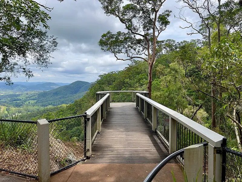
Mapleton Falls National Park is small, but it is the highlight here. The Wompoo circuit, a 1.3 km Grade 2 loop, winds through rainforest and eucalypt forest to Peregrine lookout, with views of the falls and the Obi Obi valley. Listen for the booming call of the wompoo fruit dove, and watch for peregrine falcons, which often soar and roost near the cliff edges in August and September. A wheelchair accessible lookout sits 50 metres from the car park. North of the park the Great Walk follows Daymar Road for about 400 metres, crosses Delicia Road and enters the open forest of Mapleton National Park.
Getting there and facilities
From Mapleton township, take Obi Obi Road and turn right onto Mapleton Falls Road for the falls, or right onto Delicia Road for the Great Walk entrance about 2 km along. Mapleton Falls has toilets, including an accessible one, beside the car park and a grassy picnic area with tables a short walk away. Leafy Lane has very limited parking and no facilities. Camping is not allowed in Mapleton Falls National Park.
Before you go
Parts of the Great Walk follow roads and footpaths outside the parks, so watch for traffic. Expect ticks, leeches and stinging trees along the track, so wear long clothing and repellent and check yourself often. The nearest walkers' camps are Ubajee, 2.9 km from Leafy Lane, and Flaxton to the south. Read the QPWS walking page and the Mapleton Falls things to do page, and check Queensland park alerts before you go.
Elevation
- Climb
- 100 m
- Descent
- 140 m
- Highest
- 461 m
- Lowest
- 393 m
Approximate, from a 30 m terrain model, so it can overstate the climb on cliff edge tracks.
Before you go
Tell your people where you are going
Set your route and return time in FriendsFindMe. If you do not check in, the people you trust are sent a text so they know to come looking for you.
Park and state forest boundaries: CAPAD 2024 © Commonwealth of Australia (DCCEEW), CC BY 4.0; © Forestry Corporation of NSW, CC BY 3.0 AU; © State of Queensland, CC BY 4.0; © State of Victoria (DEECA), CC BY 4.0
Walk data: Queensland Parks and Wildlife Service access © The State of Queensland 2025, CC BY 4.0