
About this walk
The Adelaide100 is a walking loop of a little over 100 kilometres around Adelaide, conceived and run by Walking SA, that links the coast, the River Torrens and the Adelaide Hills. It largely follows the boundary of the Hundred of Adelaide, the land division of roughly 100 square miles that the city was laid out on in the 1800s, which is where the name comes from. This section is most of the circuit in one piece. It starts near Bridgewater, east of Stirling, heads north through the hills to Norton Summit, drops to the Torrens, follows the river through the city to the sea, runs south along the beaches to Kingston Park, then climbs back east through the southern foothills towards Belair and finishes near Crafers. The short stretch around Stirling that closes the loop is section 2.
The route
The trail is split into numbered sections, described here anticlockwise, the same way this section runs. From Monument Road near Norton Summit (section 4B, 21 km), the trail enters Morialta Conservation Park, with its three waterfalls, Giants Cave and Rocky Hill, then crosses Black Hill Conservation Park and comes down through Wadmore Park and along Fifth Creek to Thorndon Park at Newton, the first reservoir built for Adelaide. Section 5 (16.7 km) follows the River Torrens, Karrawirra Parri, through the linear park into the city past Adelaide Oval. Section 6 (14.2 km) continues down the river past Bonython Park and the restored Breakout Creek wetlands to the coast. Section 7 (11 km) follows the Coast Park Path past Glenelg, the Patawalonga and Brighton to the Tjilbruke Monument at Kingston Park. Section 1A (10.2 km) climbs from Kingston Beach through Seacliff Park into O'Halloran Hill Recreation Park and on to Glenthorne National Park (Ityamaiitpinna Yarta).
Beyond Glenthorne, the plan is for the trail to pass Happy Valley Reservoir, Sturt Gorge Recreation Park and Belair National Park, then go through the hills via Stirling and Basket Range. Those sections may still be under construction and not yet marked, so check the trail sections page to see which parts are signposted before you plan a walk on them.
What it is like
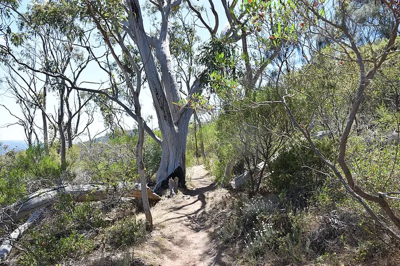
Through the suburbs the trail is mostly wide sealed shared paths that suit prams, wheelchairs, bikes and dogs, with frequent toilets and cafes. In the hills it uses park trails, fire tracks and some road verges, with big climbs and descents: section 4B is the most rugged part. Two creek crossings in section 4B, one entering Morialta from Colonial Drive and one on Fifth Creek near Manresa Court, can be impassable after heavy rain, and the trail FAQ has road detours for both. Allow 5 or 6 days to walk the whole loop continuously.
Getting there and facilities
Trains, buses and trams serve the city and coast sections, and Seacliff and Marino stations are close to Kingston Park. There is no public transport to the start of section 4B on Monument Road, where parking is very limited; there is more parking in Norton Summit and at the bottom of Morialta off Stradbroke Road. Caravan parks, hotels and other accommodation sit along the route. Each section page has a printable map, a GPX file and lists of toilets and food stops.
Before you go
Dogs are welcome on the river and coast sections and on a lead in O'Halloran Hill Recreation Park, but not in Morialta, Black Hill or Thorndon Park. Hills parks close on days of Catastrophic Fire Danger and may close on Extreme days, which can happen from October to mid April. From December to March, walk the suburban sections early in the day to avoid the afternoon heat. Read the Adelaide100 FAQ and check Parks SA closures and alerts before you go.
Elevation
- Climb
- 2,700 m
- Descent
- 2,650 m
- Highest
- 619 m
- Lowest
- 2 m
Approximate, from a 30 m terrain model, so it can overstate the climb on cliff edge tracks.
Before you go
Tell your people where you are going
Set your route and return time in FriendsFindMe. If you do not check in, the people you trust are sent a text so they know to come looking for you.
Park and state forest boundaries: CAPAD 2024 © Commonwealth of Australia (DCCEEW), CC BY 4.0; © Forestry Corporation of NSW, CC BY 3.0 AU; © State of Queensland, CC BY 4.0; © State of Victoria (DEECA), CC BY 4.0
Walk data: Recreation Trails © Crown in right of the State of South Australia (Department for Environment and Water), CC BY 4.0