
About this walk
The Bararranna Gorge Walk is a loop in Arkaroola Wilderness Sanctuary, the privately run wildlife sanctuary of about 610 square kilometres in the northern Flinders Ranges, next to Vulkathunha-Gammon Ranges National Park. It is a 6.8 km loop of about 3.5 hours, and it starts and finishes a little under 5 km east of Arkaroola Village.
What you see
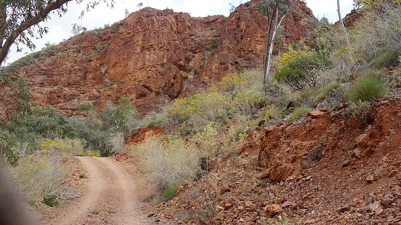
The route winds over shaly hills and then runs between the high walls of Arkaroola Creek through Bararranna Gorge, so the view changes often. Arkaroola's guided geology tour stops at the gorge to show its near vertical cliffs, which formed as sediment on an ancient sea floor, and the walk is among the best for seeing the area's old rock formations. The walk passes close to the ruins of the Welcome Mine, another stop on that tour, and near the old Wheal Hancock mine. Take care around any old workings.
Watch the rocky slopes for yellow-footed rock wallabies, the sanctuary's best known animal, and the sky for wedge-tailed eagles and brown falcons. The red-barred dragon, a colourful lizard known only from this region, also lives in the sanctuary. Swimming in waterholes is not allowed, because wildlife relies on the thin layer of fresh water that sits on top of the salty water below.
Getting there and facilities
Arkaroola is about 600 km north of Adelaide, at the end of unsealed roads from Copley (130 km) or Blinman (152 km). Bararranna Gorge is in the southern part of the sanctuary, which is reachable by both 2WD and 4WD vehicles. If you hire a car, check that the rental allows dirt roads. Arkaroola Village has a restaurant and bar, fuel and repairs, a shop, lodges, cabins and a caravan park, plus Telstra mobile service. Campers should bring as much drinking water as they can, as potable water is limited.
Before you go
Pick up a bushwalking guide at reception and ask about conditions on the day; Arkaroola's number is +61 8 8648 4848. Summer temperatures reach 35 to 40°C and Arkaroola may close over the peak of summer, so plan walks for the cooler months and start early. Carry water, sunscreen and a hat. Walk details are on the Arkaroola self drive and bushwalking page, and other walks from the village include Mawson Spriggina, Acacia Ridge and Griselda Hill.
Elevation
- Climb
- 190 m
- Descent
- 190 m
- Highest
- 320 m
- Lowest
- 204 m
Approximate, from a 30 m terrain model, so it can overstate the climb on cliff edge tracks.
Before you go
Tell your people where you are going
Set your route and return time in FriendsFindMe. If you do not check in, the people you trust are sent a text so they know to come looking for you.
Walk data: Recreation Trails © Crown in right of the State of South Australia (Department for Environment and Water), CC BY 4.0