
About this walk
The Gorge Hike is the hardest of the short walks in Onkaparinga River National Park, about 35 kilometres south of Adelaide. It starts at the Sundews car park on Piggott Range Road, drops steeply from the Sundews lookout to the floor of the Onkaparinga Gorge, follows the river downstream, then climbs back up to the ridge top and the car park. It is 6 kilometres and 4 hours, Grade 4, which means bushwalking experience is recommended.
What it is like
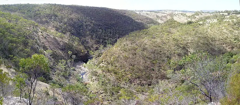
Down in the gorge you walk beside the Onkaparinga River among river red gums, below the rocky outcrops you look down on from the Sundews lookout. The ridges carry a low woodland of pink gum, dryland tea tree and sheoak, and the eastern end of the park has grey box and sheoak forest. Kangaroos, echidnas, koalas and possums live in the park, and yellow-tailed black cockatoos are often heard before they are seen. The park is Kaurna country: the name Onkaparinga comes from Ngangkiparingka, women only places along the river.
The descent and the climb out are both steep, and parts of the track along the river are not well defined, so take a map and watch for markers. In winter the river runs deep and fast and it should not be crossed, and environmental flows are also released at times. The River Hike from the same network meets the Gorge Hike at the bottom of the gorge, and the Sundews Ridge and Sundews Lookout hikes stay on the top if you want a shorter outing.
Getting there and facilities
The Sundews car park is on Piggott Range Road, on the northern side of the gorge, where most of the park's walking trails begin. It has an accessible parking bay and an accessible toilet. Vehicle entry is free. Pink Gum Campground at the eastern end of the park has 11 sites that must be booked. Dogs are not allowed in the park, and fishing is not permitted in the national park.
Before you go
Mobile coverage is patchy, especially in low ground like the gorge. Carry plenty of water, wear sturdy shoes, a hat and sunscreen, avoid the hottest part of the day, and tell someone your route and return time. The park closes on Catastrophic fire danger days and may close on Extreme days. Check the Onkaparinga River National Park page and the National Parks SA closures and alerts before you go.
Elevation
- Climb
- 180 m
- Descent
- 180 m
- Highest
- 248 m
- Lowest
- 82 m
Approximate, from a 30 m terrain model, so it can overstate the climb on cliff edge tracks.
Before you go
Tell your people where you are going
Set your route and return time in FriendsFindMe. If you do not check in, the people you trust are sent a text so they know to come looking for you.
Park and state forest boundaries: CAPAD 2024 © Commonwealth of Australia (DCCEEW), CC BY 4.0; © Forestry Corporation of NSW, CC BY 3.0 AU; © State of Queensland, CC BY 4.0; © State of Victoria (DEECA), CC BY 4.0
Walk data: Recreation Trails © Crown in right of the State of South Australia (Department for Environment and Water), CC BY 4.0