
About this walk
The Second Falls Hike is a loop above Morialta Gorge in Morialta Conservation Park, in the foothills about 10 kilometres north east of Adelaide. It is 5.3 kilometres and about 2 hours 30 minutes. You join the loop a short way up from the Morialta Falls Trailhead rather than at the car park.
What you see
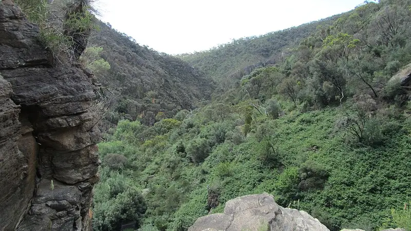
Three lookouts sit along it: Kookaburra Rock, Eagles Nest and Deep View, looking across Morialta Gorge and back over the Adelaide suburbs. You look down on First Falls from above, then cross Fourth Creek on a bridge right at the top of Second Falls. The gorge walls are old seabed rock that has been tilted, lifted and cut through by the creek, and the slopes carry stringybark, pink gum, blue gum and red gum woodland. Kangaroos graze the grassy slopes, and the heath on the ridges is home to the endangered chestnut rumped heathwren.
What it is like
This hike needs some bushwalking experience. Parts are steep, the ground is rocky and uneven, and it gets slippery when wet. Several stretches run close to cliff edges, so keep to the marked track, watch children closely and never climb over a barrier. It is best walked anticlockwise. The Third Falls Hike continues from the bridge at Second Falls if you want a longer day.
Getting there and facilities
Park at the Morialta Falls Trailhead car park at the end of the access road, or at the Morialta Road entrance in Woodforde and follow the creek path about 800 metres up. Public transport also reaches the park from the city. Entry is free, and the vehicle gates open from 6:30 am to 7 pm (9 pm in daylight saving time). Toilets are at the First Falls car park and at the Stradbroke Road picnic area, which has barbecues and Adelaide's largest playground. Dogs are allowed on a lead only in the recreation zone near the picnic area, not on the hike.
Before you go
Phone reception is very limited across most of the park. Take water, wear sturdy shoes, and let someone know when you expect to be back. Morialta closes on Catastrophic fire danger days and may close on Extreme days. Check the National Parks SA closures and alerts page and the Morialta Conservation Park page before you go.
Elevation
- Climb
- 250 m
- Descent
- 260 m
- Highest
- 343 m
- Lowest
- 190 m
Approximate, from a 30 m terrain model, so it can overstate the climb on cliff edge tracks.
Before you go
Tell your people where you are going
Set your route and return time in FriendsFindMe. If you do not check in, the people you trust are sent a text so they know to come looking for you.
Park and state forest boundaries: CAPAD 2024 © Commonwealth of Australia (DCCEEW), CC BY 4.0; © Forestry Corporation of NSW, CC BY 3.0 AU; © State of Queensland, CC BY 4.0; © State of Victoria (DEECA), CC BY 4.0
Walk data: Recreation Trails © Crown in right of the State of South Australia (Department for Environment and Water), CC BY 4.0