
About this walk
Walk the Yorke is a shared walking and cycling trail of more than 500 km around the coast of Yorke Peninsula, from Port Wakefield at the top of Gulf St Vincent down the east coast, around the foot of the peninsula and up the west coast to Moonta Bay. This is the larger of two pieces: it starts just south of Port Vincent and follows the trail south and west all the way to Moonta Bay. This stretch has 12 sections that add up to about 372 km; the other section covers Port Wakefield to Port Vincent.
The route
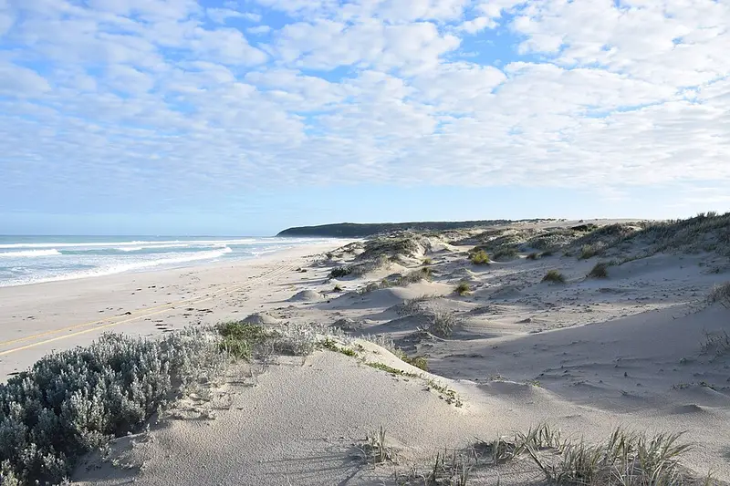
From Port Vincent the trail follows clifftops and beaches to Stansbury, once called Oyster Bay, then passes the old lime kiln at Wool Bay, the grain port at Port Giles, the bird hide at Coobowie and the tidal swimming pool at Edithburgh. Around the heel of the peninsula it passes the 55 turbines of the Wattle Point Wind Farm and the Troubridge Hill Lighthouse, then crosses the edge of Point Davenport Conservation Park on the way to Foul Bay. Foul Bay to Marion Bay (25.3 km) has beach walking, dune climbs and rock hopping, and experienced walkers allow up to 10 hours for it. The trail then crosses Dhilba Guuranda-Innes National Park and follows the surf coast past Gym Beach, Formby Bay and Daly Head to Gleesons Landing and Corny Point. Up the west coast it is mostly long beaches: Point Turton, Hardwicke Bay, Port Rickaby, Wauraltee Beach, Port Victoria, the Nharangga lands at Point Pearce, Balgowan and Cape Elizabeth to Moonta Bay.
Underfoot
Times are estimated at 4 km an hour, but soft sand, seaweed and rocky beaches can halve that. Check tide times: beach sections are easier at low tide, and the markers that lead you off a beach sit above the high tide mark, so watch for them. Between Gym Beach and Formby Bay there is no formed track, only markers on the dunes and headlands along a narrow strip of Crown land beside private property.
Water, camping and rules
Shelters along the trail have rainwater tanks that depend on rain, so treat that water. Carry 2 litres for a cool day and at least 3 above 28 degrees; you can buy water in towns including Port Vincent, Stansbury, Edithburgh, Marion Bay, Corny Point, Port Rickaby, Port Victoria and Balgowan. Walkers without a support vehicle may use the council's 19 bush camping grounds free, but camping is not allowed in conservation parks, and Innes campsites must be booked. Walkers do not pay the Innes park entry fee. Walk below the high tide mark to protect nesting hooded plovers, from early spring to late March.
Before you go
Summer walking is not recommended, campfires are banned in the fire danger season, mobile coverage is unreliable and a personal locator beacon is advised. Read the Walk the Yorke trail notes for detours and closures, check the National Parks SA alerts for Innes, and see the section guides on Yorke Peninsula Tourism.
Elevation
- Climb
- 1,550 m
- Descent
- 1,600 m
- Highest
- 52 m
- Lowest
- 1 m
Approximate, from a 30 m terrain model, so it can overstate the climb on cliff edge tracks.
Before you go
Tell your people where you are going
Set your route and return time in FriendsFindMe. If you do not check in, the people you trust are sent a text so they know to come looking for you.
Park and state forest boundaries: CAPAD 2024 © Commonwealth of Australia (DCCEEW), CC BY 4.0; © Forestry Corporation of NSW, CC BY 3.0 AU; © State of Queensland, CC BY 4.0; © State of Victoria (DEECA), CC BY 4.0
Walk data: Recreation Trails © Crown in right of the State of South Australia (Department for Environment and Water), CC BY 4.0