
About this walk
The Yurrebilla Trail runs along the hills face east of Adelaide, from Belair railway station in the south to Ambers Gully on the River Torrens in the north, and this walk follows the whole trail. It is 53 kilometres, walked in 3 to 5 days, and every section is Grade 4, a hard hike. It was opened on 2 September 2003. The name is thought to come from the Kaurna word Yuridla, meaning "two ears", for the twin peaks of Mount Lofty and Mount Bonython, the same word that gave Uraidla its name.
The route
The trail divides into one full day and four half day sections:
- Section 1, Belair railway station to Eagle on the Hill (18 km): the edge of Belair National Park, Brownhill Creek and the open grassy ridgetops of Waite Conservation Reserve.
- Section 2, Eagle on the Hill to Summertown (7.3 km): the winding forest tracks and steep hills of Cleland National Park.
- Section 3, Summertown to Norton Summit (9 km): Horsnell Gully and Giles conservation parks, with old stone ruins and koalas, sharing part of its way with the Heysen Trail.
- Section 4, Norton Summit to Morialta (5.5 km): past the old Morialta Barns and down through the creeks and waterfalls of Morialta Conservation Park.
- Section 5, Morialta to Ambers Gully (13.4 km): across Black Hill Conservation Park and down Ambers Gully to the Torrens.
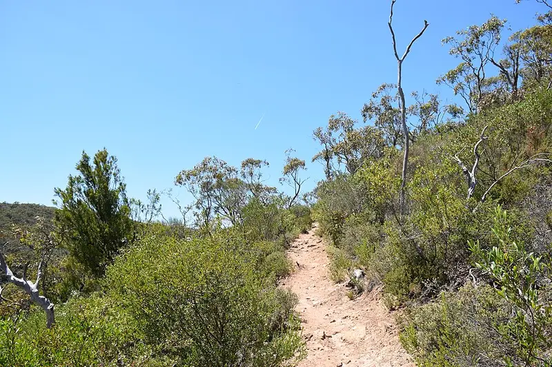
Along the way the trail passes Carrick Hill, Waterfall Gully, Mount Lofty Summit, Mount Lofty Botanic Garden and Cleland Wildlife Park. Much of it is old footpads, fire tracks (the wide gravel roads rangers use) and road reserves, joined by newer sections, so the surface changes from narrow single tracks to vehicle tracks. Expect long climbs and descents and views over the city and the Adelaide Plains from every section. The stretch through Black Hill, between Morialta and Ghost Tree Gully, is Grade 5, for very experienced bushwalkers, and creeks there rise quickly after rain and crossings get slippery.
Getting there and facilities
The southern start is Belair station on the Adelaide Metro train line, and sections 1 and 3 can be reached by bus or train. Belair National Park charges a vehicle entry fee and has toilets and picnic areas. Mount Lofty Summit has a cafe, toilets and a visitor information outlet, with paid parking. Morialta has toilets at the First Falls and Stradbroke Road car parks. The trail visits or links to the hills towns of Summertown, Crafers and Norton Summit, where you can find pubs and other places to stop.
Before you go
Leave the dog at home: dogs are not allowed in Cleland, Mount Lofty Summit or Black Hill, and in Morialta only in the recreation area near the car parks. The parks close on days of Catastrophic Fire Danger and may close on Extreme days. They also close at times for pest animal control; in June 2026 the Yurrebilla and Heysen trails through Horsnell and Giles were shut for four days for deer control, with walkers sent along Woods Hill and Ridge roads. Mobile coverage is patchy in Cleland, especially in the gullies. Walking SA's Yurrebilla Trail page links each section with a topographic map and GPX file. Check Parks SA closures and alerts before you go.
Elevation
- Climb
- 1,750 m
- Descent
- 1,950 m
- Highest
- 622 m
- Lowest
- 120 m
Approximate, from a 30 m terrain model, so it can overstate the climb on cliff edge tracks.
Before you go
Tell your people where you are going
Set your route and return time in FriendsFindMe. If you do not check in, the people you trust are sent a text so they know to come looking for you.
Park and state forest boundaries: CAPAD 2024 © Commonwealth of Australia (DCCEEW), CC BY 4.0; © Forestry Corporation of NSW, CC BY 3.0 AU; © State of Queensland, CC BY 4.0; © State of Victoria (DEECA), CC BY 4.0
Walk data: Recreation Trails © Crown in right of the State of South Australia (Department for Environment and Water), CC BY 4.0