
About this walk
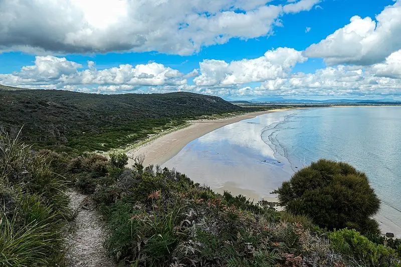
This coastal walk crosses the headlands at the eastern end of Narawntapu National Park on Tasmania's central north coast, between Bakers Beach and the small settlement of Badger Head. This walk starts where the Archers Knob Track comes down to Bakers Beach, follows the beach east, then climbs a marked zigzag track up Little Badger Head, drops into the sheltered little Copper Cove and continues over the headland to Badger Head. The track from the eastern end of Bakers Beach to Badger Head is about 6 kilometres.
The full Copper Cove/Badger Head walk is a 23 kilometre return trip of 6 to 8 hours from the Springlawn visitor centre, Grade 3: some bushwalking experience recommended, with short steep hills, a rough surface and many steps. You can also start at Badger Head and walk it the other way.
The park
Narawntapu was called Asbestos Range National Park until 1999, and it was the first park to go back to an Aboriginal name: Narawntapu is the name for the Badger Head and West Head area. Shell middens and artefact scatters along this coast are protected and should be left undisturbed. Expect coastal heath and wildflowers, and on the open grassland near Springlawn, Forester kangaroos, Bennetts wallabies and pademelons, especially at dusk.
Getting there
For the Bakers Beach end, take the B71 about 30 minutes east of Devonport and turn onto Bakers Beach Road (C740) into the park. For the Badger Head end, drive up the West Tamar Highway (A7) from Launceston and turn onto the C721 for Badger Head, under an hour from Launceston. You need a valid Tasmanian national parks pass.
Facilities
The Springlawn visitor centre has toilets, picnic facilities and staff who can advise on the tracks; there are also toilets at Bakers Point and Griffiths Point, and picnic facilities at Badger Head. There are no toilets along the walking tracks. There is no drinking water at Badger Beach and no permanent fresh water along the walks, so carry your own. Camping is available at Springlawn, Bakers Point and other sites in the park.
Before you go
Parts of the beaches are cut off at high tide and in big swells, so check the tides first. None of the beaches are patrolled, and Badger Beach has rips and undertows. For a longer day, the Coastal Traverse links Bakers Beach, Badger Head and West Head to Greens Beach, 21 kilometres one way. Check the Parks and Wildlife Service alerts page and the Copper Cove/Badger Head walk page before you go.
Elevation
- Climb
- 160 m
- Descent
- 160 m
- Highest
- 71 m
- Lowest
- 2 m
Approximate, from a 30 m terrain model, so it can overstate the climb on cliff edge tracks.
Before you go
Tell your people where you are going
Set your route and return time in FriendsFindMe. If you do not check in, the people you trust are sent a text so they know to come looking for you.
Park and state forest boundaries: CAPAD 2024 © Commonwealth of Australia (DCCEEW), CC BY 4.0; © Forestry Corporation of NSW, CC BY 3.0 AU; © State of Queensland, CC BY 4.0; © State of Victoria (DEECA), CC BY 4.0
Walk data: LIST Transport Segments from theLIST © State of Tasmania, CC BY 3.0 AU