
About this walk
The Cradle Valley Boardwalk runs up Cradle Valley in Cradle Mountain-Lake St Clair National Park, part of the Tasmanian Wilderness World Heritage Area. It follows the valley floor between the Dove River and the park road, so you can walk into the park instead of riding the shuttle bus. This walk starts near the Cradle Mountain Visitor Centre, passes the Interpretation Centre and Ranger Station, and finishes at Ronny Creek, the departure point for the Overland Track. It is one way, so plan to walk back or catch the shuttle.
What it is like
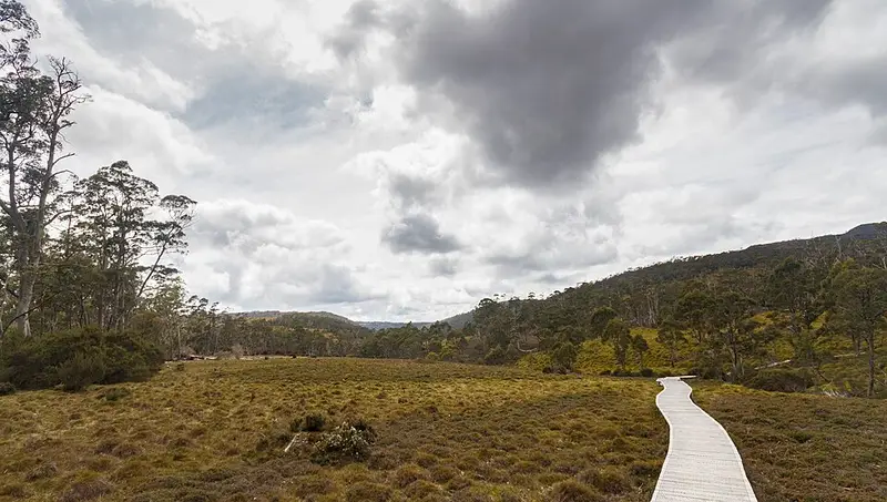
The route is mostly boardwalk through moorland and rainforest. Shortly after the Ranger Station you pass the turn to the Rainforest Walk, and about a kilometre further on the turn to Dove Canyon. Two short side tracks lead down to the Dove River, and the boardwalk meets the road in a few places, including the Snake Hill shuttle stop. Near the end you cross the Dove River on a bridge and pass some private houses before reaching Ronny Creek. The park's wildlife includes wombats, echidnas, platypus, quolls and Tasmanian devils.
Getting there and facilities
Park at the visitor centre, which has a café, toilets, a first aid room and an undercover picnic area. You need a valid parks pass. The shuttle bus stops at the visitor centre, the Interpretation Centre, Snake Hill, Ronny Creek and Dove Lake, and private cars are not allowed into the park while it runs. Adults pay $15.50 for a shuttle ticket valid for 72 hours unless they hold a Cradle Mountain Icon pass or Overland Track pass; under 18s ride free. There are picnic shelters with electric barbecues beside the Interpretation Centre and picnic tables at Ronny Creek.
Before you go
Cradle Valley sits high enough for snow, rain and wind in any month, so carry a waterproof jacket and warm layers even for a short walk. The visitor centre is on (03) 6492 1110. Check the Parks and Wildlife Service alerts page, the Cradle Mountain page and the shuttle bus information before you go.
Elevation
- Climb
- 190 m
- Descent
- 130 m
- Highest
- 891 m
- Lowest
- 789 m
Approximate, from a 30 m terrain model, so it can overstate the climb on cliff edge tracks.
Before you go
Tell your people where you are going
Set your route and return time in FriendsFindMe. If you do not check in, the people you trust are sent a text so they know to come looking for you.
Park and state forest boundaries: CAPAD 2024 © Commonwealth of Australia (DCCEEW), CC BY 4.0; © Forestry Corporation of NSW, CC BY 3.0 AU; © State of Queensland, CC BY 4.0; © State of Victoria (DEECA), CC BY 4.0
Walk data: LIST Transport Segments from theLIST © State of Tasmania, CC BY 3.0 AU