
About this walk
The Lake Rodway Track is a rough alpine track in Cradle Mountain-Lake St Clair National Park that runs from Dove Lake, over the shoulder of Hansons Peak and down to Lake Rodway behind Cradle Mountain, then climbs on to meet the Overland Track at the back of the mountain. This walk follows that whole route from north to south. It leaves the Dove Lake Circuit on the eastern shore just after Glacier Rock, passes the Rangers Hut junction, drops to the Scott-Kilvert Memorial Hut on Lake Rodway, and finishes on the Overland Track south of Cradle Mountain. Most people walk only part of it, as the start of a day climb of Hansons Peak, as a route to the hut, or as one leg of a longer loop.
Take the descriptions below as a guide only and confirm conditions with the Cradle Mountain Visitor Centre.
The route
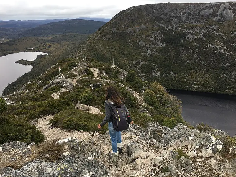
From the Dove Lake Circuit the track climbs steadily up the slopes of Hansons Peak (about 1,180 metres). The final pitch onto the ridge is very steep and rocky, with a chain fixed to help on the scramble, and icy in winter. From the saddle you get your first view of Lake Hanson, the Twisted Lakes Track branches off, and there is a long view back down Dove Lake. Walkers who want to avoid the chain can go around behind the peak by way of Lake Hanson and Twisted Lakes, but that route drops lower, climbs back up and is rougher underfoot.
South of the peak the track reaches the junction near Rangers Hut, where the Cradle Mountain Face Track comes in from Kitchen Hut. From there it descends towards Lake Rodway, steeply in places, to the A-frame Scott-Kilvert Memorial Hut beside the lake under the southern cliffs of Cradle Mountain. The hut honours teacher Ewen Scott and student David Kilvert of Riverside High School, who died in near blizzard conditions near Cradle Mountain on 20 May 1965. The school and local walking clubs built it with money from a public appeal, floating eight King Billy pine logs 300 metres across the lake for its main frame, and it was dedicated in April 1966. There is a campsite, toilet and helipad beside it. Beyond the lake the track climbs out of the valley to the Overland Track, a section more overgrown and harder on the knees than the northern half.
Getting there
The northern end is on the Dove Lake Circuit, reached by the Cradle Mountain shuttle bus from the visitor centre (about 20 minutes, with a fee) or by private car outside shuttle hours, when there are only nine parking spaces at Dove Lake. You need a valid Tasmanian parks pass.
Before you go
This is exposed alpine country. Snow, rain, strong wind and sun can come in any month and people have died caught unprepared in cold, wet, windy weather. Carry a waterproof jacket and overtrousers, warm layers, a hat and gloves, a map and enough food to wait out a change. The park is fuel stove only. Record your trip in the log books, read the Cradle Mountain page, and check the Parks and Wildlife Service alerts page before you go.
Elevation
- Climb
- 530 m
- Descent
- 260 m
- Highest
- 1,236 m
- Lowest
- 924 m
Approximate, from a 30 m terrain model, so it can overstate the climb on cliff edge tracks.
Before you go
Tell your people where you are going
Set your route and return time in FriendsFindMe. If you do not check in, the people you trust are sent a text so they know to come looking for you.
Park and state forest boundaries: CAPAD 2024 © Commonwealth of Australia (DCCEEW), CC BY 4.0; © Forestry Corporation of NSW, CC BY 3.0 AU; © State of Queensland, CC BY 4.0; © State of Victoria (DEECA), CC BY 4.0
Walk data: LIST Transport Segments from theLIST © State of Tasmania, CC BY 3.0 AU