
About this walk
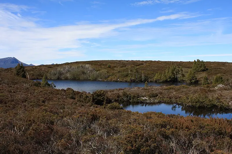
Lake Will is an alpine lake just west of the Overland Track in Cradle Mountain-Lake St Clair National Park. The side track leaves the Overland Track on the stretch between Waterfall Valley and Lake Windermere, which is the second day for most walkers heading south, and runs west across the plateau to the lake. It is a 3 kilometre, one hour return side trip from the track junction, a relaxed walk to a lake that is popular as a lunch stop.
This walk goes further than that. After it reaches the eastern shore, it follows the edge of the lake south for roughly another kilometre, along the old pad walkers use to reach Innes Falls. Past the lake the track becomes wet and overgrown, so the continuation is a much rougher outing than the trip to the lake.
What it is like
This part of the Overland Track crosses alpine heath, lakes and tarns above 1,000 metres, and it is exposed. Walking times stretch out in blizzards and snow cover, and alpine weather here can turn at any time of year. Carry a waterproof jacket and warm layers even on a short side trip.
Getting there
There is no road access. You reach the junction on foot along the Overland Track, beyond Waterfall Valley Hut, which is 10.7 kilometres from Ronny Creek at Cradle Mountain. From 1 October to 31 May the Overland Track has to be booked, independent walkers must walk it north to south, and up to 34 of them may start on any day; the booking covers your park entry. Outside that season you need a valid Tasmanian national parks pass. A personal locator beacon is recommended, and you can hire one from Service Tasmania shops.
Facilities
There are none at the lake. The nearest huts, Waterfall Valley and Lake Windermere, each sleep 34 and have composting toilets and rainwater tanks; boil or treat the water before you drink it. Camping is not allowed around Lake Windermere itself, and the tent platforms there sit about 500 metres from the shore.
Read the Overland Track walk notes and the Overland Track FAQs, and check the Parks and Wildlife Service alerts page before you go.
Elevation
- Climb
- 10 m
- Descent
- 40 m
- Highest
- 1,083 m
- Lowest
- 1,051 m
Approximate, from a 30 m terrain model, so it can overstate the climb on cliff edge tracks.
Before you go
Tell your people where you are going
Set your route and return time in FriendsFindMe. If you do not check in, the people you trust are sent a text so they know to come looking for you.
Park and state forest boundaries: CAPAD 2024 © Commonwealth of Australia (DCCEEW), CC BY 4.0; © Forestry Corporation of NSW, CC BY 3.0 AU; © State of Queensland, CC BY 4.0; © State of Victoria (DEECA), CC BY 4.0
Walk data: LIST Transport Segments from theLIST © State of Tasmania, CC BY 3.0 AU