
About this walk
The Liffey River Track links the upper Liffey Falls picnic area with the Highland Lakes Road on the Central Plateau. This walk leaves the day use area at the top car park of Liffey Falls State Reserve and follows the Liffey River upstream to the south west, climbing the Great Western Tiers to finish on the Highland Lakes Road near Pine Lake.
This is a rough bushwalking track, mostly unimproved, so expect a much rougher path than the made tracks to the falls.
Liffey Falls State Reserve
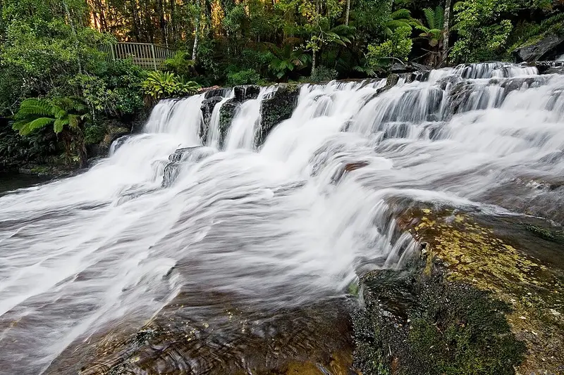
The reserve protects cool temperate rainforest beneath the Tiers and is part of the Tasmanian Wilderness World Heritage Area. Water from the plateau wears away soft mudstone to leave sandstone steps, giving four main cascades: Alexandra, Hopetoun and Albert Falls, then Victoria Falls, usually just called Liffey Falls. From the top car park the falls walk is 2 kilometres and 45 minutes return, Grade 2. A few minutes from the car park is the Big Tree, a gum topped stringybark about 50 metres tall with a trunk more than 3 metres across. Look for pink robins, green rosellas and, in the river, platypus and giant freshwater crayfish.
For thousands of years the area was a meeting place for the Big River, North and North Midlands peoples. Loggers arrived in the 1900s, and the picnic area was once a logging camp. The river's Aboriginal name was Tellerpangger; settlers called it Pennyroyal Creek before it was renamed after the Liffey in Ireland.
Getting there and facilities
From Deloraine or Great Lake, take the Highland Lakes Road (A5) and turn at the sign onto Riversdale Road (C513). It is unsealed, narrow and winding, and not suitable for buses, trailers, caravans or motorhomes. The top car park has toilets, shelters, picnic facilities and free gas barbecues, and is day use only. No parks pass is needed. Dogs and bikes are not permitted in the reserve.
At the top of the track, the Pine Lake boardwalk is a level 30 minute return walk through pencil pines and alpine plants, Grade 1.
Before you go
The upper end of the track is high plateau country where the weather can turn cold, wet and windy at any time of year, so carry warm and waterproof layers and a map. Read the Parks Liffey Falls State Reserve page and check the Parks and Wildlife Service alerts page before you go.
Elevation
- Climb
- 660 m
- Descent
- 10 m
- Highest
- 1,208 m
- Lowest
- 567 m
Approximate, from a 30 m terrain model, so it can overstate the climb on cliff edge tracks.
Before you go
Tell your people where you are going
Set your route and return time in FriendsFindMe. If you do not check in, the people you trust are sent a text so they know to come looking for you.
Park and state forest boundaries: CAPAD 2024 © Commonwealth of Australia (DCCEEW), CC BY 4.0; © Forestry Corporation of NSW, CC BY 3.0 AU; © State of Queensland, CC BY 4.0; © State of Victoria (DEECA), CC BY 4.0
Walk data: LIST Transport Segments from theLIST © State of Tasmania, CC BY 3.0 AU