
About this walk
The Moonlight Ridge Track is the eastern end of the Southern Ranges, the high, exposed ranges that run west from Lune River towards Precipitous Bluff in Southwest National Park. This walk starts at the walkers' registration booth near Lune River, shares its first stretch with the walk to Mystery Creek Cave, climbs onto Moonlight Ridge and follows the open tops past Pigsty Ponds to Pindars Peak. From there the Precipitous Bluff Track carries on west to New River Lagoon and the South Coast Track, a combination usually called the Southern Ranges traverse.
Treat the details below as a guide to conditions rather than a promise.
The route
Past the old limestone quarry the track is signed for either the caves or the Southern Ranges. It then climbs steeply through forest, levels for a while, and climbs again to the plateau. A bushfire has burnt across Moonlight Ridge, leaving open, boggy ground with several pads running in the same direction, especially around Moonlight Creek, where wooden posts with arrows (some charred or missing their arrows) mark the way. A last climb, with some overgrown track, steps and boardwalk, leads up Hill One, and from there the going is mostly rocky and easier over the following hills to Pigsty Ponds.
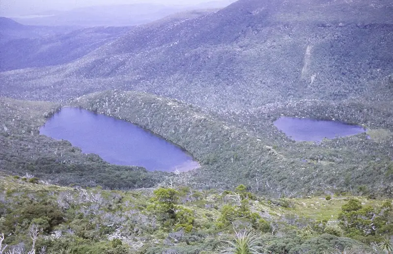
Most groups take about 8 hours from the car park to Pigsty Ponds. Water is scarce: apart from the creek near the start, the next water is in tarns on the plateau and on Hill One, which can be low or dry in a dry season. The burnt campsite at Moonlight Creek is boggy and unsheltered. There is better camping at Pigsty Ponds, in more sheltered spots by the Reservoir Lakes about 15 minutes away, and at the tarns on Moores Bridge among King Billy pines. Side trips go to Mount La Perouse, where the junction is marked only by an arrow of stacked rocks, and to Pindars Peak.
Getting there
From Lune River, turn into South Lune Road, then about 4 to 5 kilometres along turn left towards the old quarry on Limestone Quarry Road, where there is parking and the registration booth. Sign in before you go. Southwest National Park needs a Tasmanian parks pass.
Before you go
This is exposed alpine country, and snow, rain, strong wind and sun can occur at any time of year in Tasmania's high areas. Winds on the tops can be strong enough to stop you, so carry a tent that can take it and allow spare days for bad weather. The full traverse to Precipitous Bluff and out along the South Coast Track to Cockle Creek is about 88 kilometres, and most parties take 9 to 10 days. Check the Southwest National Park page and the Parks and Wildlife Service alerts page before you go.
Elevation
- Climb
- 1,600 m
- Descent
- 640 m
- Highest
- 1,163 m
- Lowest
- 142 m
Approximate, from a 30 m terrain model, so it can overstate the climb on cliff edge tracks.
Before you go
Tell your people where you are going
Set your route and return time in FriendsFindMe. If you do not check in, the people you trust are sent a text so they know to come looking for you.
Park and state forest boundaries: CAPAD 2024 © Commonwealth of Australia (DCCEEW), CC BY 4.0; © Forestry Corporation of NSW, CC BY 3.0 AU; © State of Queensland, CC BY 4.0; © State of Victoria (DEECA), CC BY 4.0
Walk data: LIST Transport Segments from theLIST © State of Tasmania, CC BY 3.0 AU