
About this walk
Mount Field West, at 1,434 metres, is the highest point in Mount Field National Park, and the walk to it from Lake Dobson takes a full day. The walk, also known as Mount Field West and Naturalist Peak, is 17 kilometres return, 8 to 9 hours, Grade 5: for very experienced bushwalkers with navigation skills and emergency first aid, on track that can be very rough, very steep and unmarked.
This walk starts at the Rodway hut and day shelter at the top of the Mount Mawson ski field and ends on the summit. Add the climb up from the Lake Dobson car park to reach it, about 30 minutes via the Urquhart Track.
The route
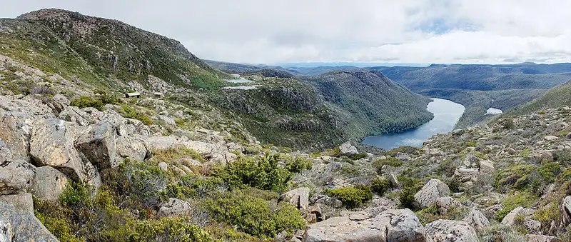
From the ski field the track climbs onto the Rodway Range, threads between the huge dolerite boulders of the Lions Den, then drops over boulder fields to K Col, where there is an emergency hut. It carries on west past Clemes Tarn and across a high, open plateau to the summit. On a clear day you look out over the Florentine Valley and into the south-west. You return the same way. The kilometres of boulder hopping on the Rodway Range are easy to underestimate, so start early.
Before you go
This is an exposed alpine walk. Weather can turn severe in any month, and it is not suitable as a day trip in the short days of winter. Mobile reception is unreliable. Carry a hooded waterproof jacket, waterproof overtrousers, warm layers and a detailed map, and sign the registration booth at Lake Dobson, then sign back in when you return. A small number of personal locator beacons can be borrowed from the Mount Field Visitor Centre. The park is a fuel stove only area, and a valid Tasmanian parks pass is required.
Getting there
Mount Field is just over an hour from Hobart via New Norfolk and Westerway. The Lake Dobson car park is 16 kilometres past the visitor centre up a winding gravel road that can be closed by snow, may need chains, and is not suited to campervans or buses. Phone the visitor centre on (03) 6288 1149 for road conditions, and check the Mount Field West page and Parks alerts before you go. The Rodway Range and Tarn Shelf circuit shares the route as far as K Col.
Elevation
- Climb
- 330 m
- Descent
- 210 m
- Highest
- 1,402 m
- Lowest
- 1,208 m
Approximate, from a 30 m terrain model, so it can overstate the climb on cliff edge tracks.
Before you go
Tell your people where you are going
Set your route and return time in FriendsFindMe. If you do not check in, the people you trust are sent a text so they know to come looking for you.
Park and state forest boundaries: CAPAD 2024 © Commonwealth of Australia (DCCEEW), CC BY 4.0; © Forestry Corporation of NSW, CC BY 3.0 AU; © State of Queensland, CC BY 4.0; © State of Victoria (DEECA), CC BY 4.0
Walk data: LIST Transport Segments from theLIST © State of Tasmania, CC BY 3.0 AU