
About this walk
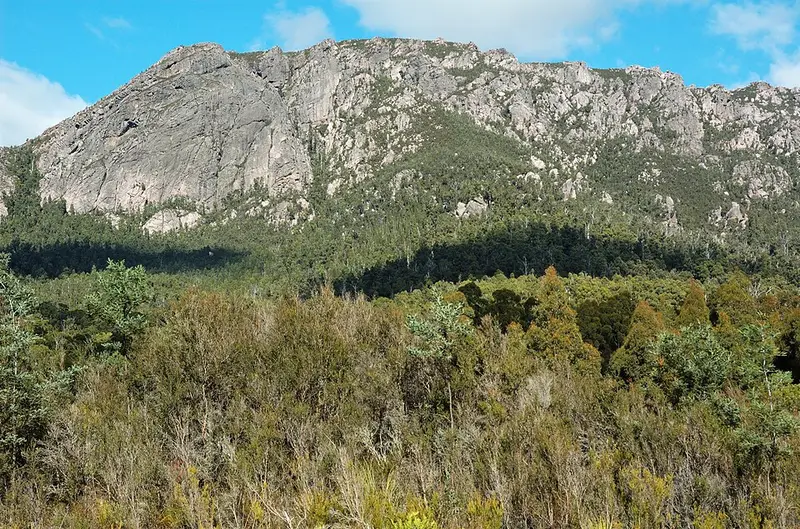
This is the main walking track up Mount Roland, the highest peak in Mount Roland Regional Reserve, south of Sheffield in north west Tasmania. This walk runs the length of the route between the summit and the trailhead on O'Neills Road near Gowrie Park. It is also called the Mount Roland Track and is 16 kilometres return on the same track, 4 to 6 hours, Grade 3, which means some bushwalking experience is recommended and you can expect short steep hills, a rough surface and many steps.
What it is like
The mountain is made of Jurassic dolerite and rises to 1,233 metres, and the climb from the car park is close to 1,000 metres. The track starts as a gentle rise through eucalypt woodland and steepens until it reaches the plateau, where it opens into buttongrass plains and heath. About 15 minutes along the plateau there is a platform with a table and bench seats, a good place to turn around if you have had enough. Beyond it you walk over loose rock, then finish with a short boulder scramble to the summit. On a clear day you can see north to Bass Strait and south west to Cradle Mountain, Barn Bluff and the Pelion Range.
For a circuit, combine this track with the Mount Vandyke Track, which leaves it at a signed junction low on the mountain and rejoins it at a junction with a viewing platform on the plateau. The Vandyke side is steep and harder to follow, and suits experienced bushwalkers only.
Getting there
From Sheffield, drive about 15 kilometres along Claude Road (C136) to Gowrie Park, turn left onto O'Neills Road and follow it for 1 kilometre to the trailhead. O'Neills Road is unsealed. There are no facilities at the trailhead; toilets and picnic facilities are in Gowrie Park. Dogs, bikes and campfires are not permitted.
Before you go
Weather on the plateau can turn quickly in any season, so carry a waterproof jacket and warm clothes, and let someone know your plans. The Leven Field Centre in Ulverstone is on (03) 6464 3008. Read the Mount Roland Track page and check the Parks and Wildlife Service alerts page before you go.
Elevation
- Climb
- 20 m
- Descent
- 910 m
- Highest
- 1,212 m
- Lowest
- 317 m
Approximate, from a 30 m terrain model, so it can overstate the climb on cliff edge tracks.
Before you go
Tell your people where you are going
Set your route and return time in FriendsFindMe. If you do not check in, the people you trust are sent a text so they know to come looking for you.
Park and state forest boundaries: CAPAD 2024 © Commonwealth of Australia (DCCEEW), CC BY 4.0; © Forestry Corporation of NSW, CC BY 3.0 AU; © State of Queensland, CC BY 4.0; © State of Victoria (DEECA), CC BY 4.0
Walk data: LIST Transport Segments from theLIST © State of Tasmania, CC BY 3.0 AU