
About this walk
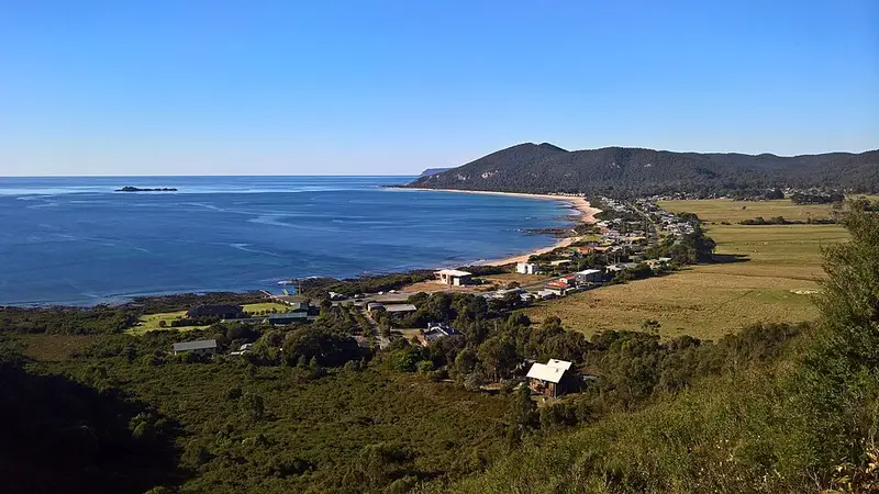
This is the inland crossing of Rocky Cape National Park on Tasmania's north west coast, over the heathy Sisters Hills between pinmatik/Rocky Cape and Sisters Beach. It is also called the Inland Track. This walk starts on Rocky Cape Road near Burgess Cove, climbs to Postmans Pass, follows the Inland Track south and east across the Sisters Hills, then comes down on the Anniversary Bay Circuit and Razorback Ridge tracks to Sisters Beach near the boat ramp.
The whole Inland Track is almost 15 kilometres and 3.5 to 4 hours one way, longer than this walk. The hills reach almost 300 metres, with views down to the coast and inland. Side tracks lead to Doone Falls, the Broadview Hills and Anniversary Bay, so you can easily stretch it to half a day or more. You can walk it from either end; leave a car at both ends or arrange a pick up.
What you see
The park's quartzite rocks are among the oldest in Tasmania, folded into contorted patterns along the coast. Low heath covers the hills, and from spring into summer it flowers with Christmas bells, boronia, tea tree, purple iris and pea flowers, with grasstrees throughout. Above Sisters Beach is a stand of saw banksia, a tree common on the mainland but in Tasmania found only here. Listen for yellow tailed black cockatoos, and watch for white bellied sea eagles over the coast. The caves along this coast were Aboriginal shelters for thousands of years; do not enter them.
Getting there
The main entrance is off the Bass Highway (A2) between Rocky Cape and Hellyer: turn onto Rocky Cape Road (C227) for Burgess Cove and the lighthouse. For Sisters Beach, leave the Bass Highway 12 kilometres west of Wynyard at the Boat Harbour turn off, follow the C232 for 1.5 kilometres, then Irbys Road (C233) for 8 kilometres. A valid Tasmanian national parks pass is needed.
Facilities and before you go
There are picnic tables, a gas barbecue and toilets at Mary Ann Cove near the Rocky Cape end, and electric barbecues at Sisters Beach. Carry your own water. Phytophthora, a soil disease that rots the roots of native plants, is common in the park, so clean the soil off your boots when you leave. The shorter Postmans Track, Banksia Grove and Caves Circuit and the rugged Coastal Route share parts of this country. Check the Parks and Wildlife Service alerts page and the Rocky Cape walks page before you go.
Elevation
- Climb
- 440 m
- Descent
- 450 m
- Highest
- 273 m
- Lowest
- 18 m
Approximate, from a 30 m terrain model, so it can overstate the climb on cliff edge tracks.
Before you go
Tell your people where you are going
Set your route and return time in FriendsFindMe. If you do not check in, the people you trust are sent a text so they know to come looking for you.
Park and state forest boundaries: CAPAD 2024 © Commonwealth of Australia (DCCEEW), CC BY 4.0; © Forestry Corporation of NSW, CC BY 3.0 AU; © State of Queensland, CC BY 4.0; © State of Victoria (DEECA), CC BY 4.0
Walk data: LIST Transport Segments from theLIST © State of Tasmania, CC BY 3.0 AU