
About this walk
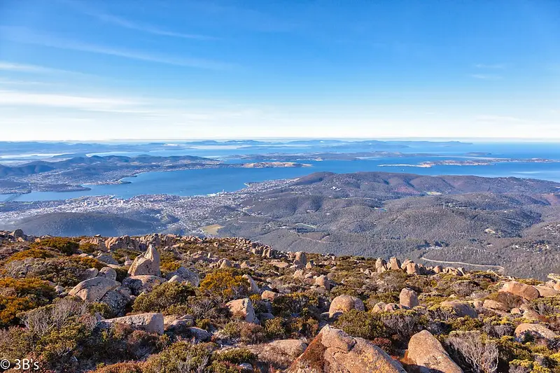
The Thark Ridge Track is a remote walk in Wellington Park, the reserve that covers kunanyi / Mount Wellington and the Wellington Range behind Hobart, the traditional lands of the Muwinina people. It leaves Pinnacle Road at Big Bend and heads south-west along Thark Ridge, past the junction with the Devils Throne Track, and down to the Old Montagu Fire Trail near Mount Montagu. From that junction an unofficial link runs down to the Wellington Falls Track, and the Mt Montagu Track climbs to the peak. This walk ends just short of Mount Montagu.
Big Bend is the starting point for the extended walks out to Thark Ridge, Collins Bonnet and Mount Connection. Plan from a map.
What it is like
This is high, exposed country. Remote and higher tracks in the park can be rough or wet underfoot and may need navigation skills in poor visibility. Rainfall on the higher peaks averages about 1,500 millimetres a year, and snow, sleet and strong wind can arrive suddenly in any season. Carry a waterproof jacket, warm layers, food, a map and compass or GPS, and a charged phone. Reception is generally good on the mountain, but there are blackspots in the remote parts of the park. Generic online maps are unreliable here, so use the fold out Bushwalking in Wellington Park map, available from the Tasmanian Travel and Information Centre in Hobart.
Getting there and rules
Big Bend is on Pinnacle Road below the summit. The road can be closed by snow and ice, at the Bracken Lane entrance or above The Springs, and you may then not be able to drive to Big Bend. Check the City of Hobart Pinnacle Road status or call 03 6238 2711. Entry to the park is free, and no parks pass is needed. This is not one of the walking tracks open to bikes, and dogs are allowed on a lead only in the foothills Recreation Zone and on a few named tracks, so check the Trust's dog walking page first. Check Wellington Park road and track updates before you go.
Elevation
- Climb
- 130 m
- Descent
- 410 m
- Highest
- 1,249 m
- Lowest
- 876 m
Approximate, from a 30 m terrain model, so it can overstate the climb on cliff edge tracks.
Before you go
Tell your people where you are going
Set your route and return time in FriendsFindMe. If you do not check in, the people you trust are sent a text so they know to come looking for you.
Park and state forest boundaries: CAPAD 2024 © Commonwealth of Australia (DCCEEW), CC BY 4.0; © Forestry Corporation of NSW, CC BY 3.0 AU; © State of Queensland, CC BY 4.0; © State of Victoria (DEECA), CC BY 4.0
Walk data: LIST Transport Segments from theLIST © State of Tasmania, CC BY 3.0 AU