
About this walk
The Great Walhalla Alpine Trail is one of the Great Trails Victoria routes. It crosses the Baw Baw Plateau in Baw Baw National Park between the alpine village at Mount Baw Baw and the old gold mining town of Walhalla. This walk is the whole trail, shown from Baw Baw Village east over the plateau and down to Walhalla. For most of its length it follows the start of the Australian Alps Walking Track, a 650 km route, Grade 5, from Walhalla to near Canberra.
The route
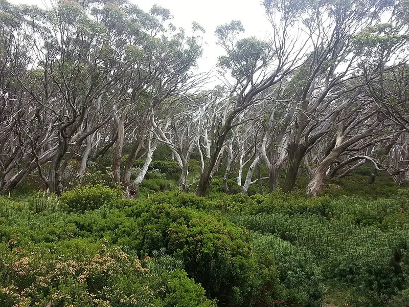
From the village the trail heads east across the plateau past a lookout on Mount Baw Baw and St Phillack Saddle, through snow gum woodland with wet alpine heath and spongy sphagnum moss around clear pools. The heathlands put on a strong wildflower display in late spring. It passes the ruins of Mount Erica hut, near the summit of Mount Erica, then descends to Mushroom Rocks, a maze of giant mossy granite tors in the forest. Below the rocks the forest turns to mountain ash and silver wattle, where you have a good chance of seeing a superb lyrebird, and the trail reaches the Mount Erica car park. From there it drops through tall forest to the Eastern Tyers Camping Area beside Tyers River East, crosses Poverty Point Bridge and reaches Walhalla, finishing at the Mountain Band Rotunda, the official start of the Australian Alps Walking Track.
Ferdinand von Mueller made the first recorded ascent of the plateau in 1860 and named Mount Erica. In 1906 a walking track was built from Warburton to Walhalla over the plateau, and after the 1939 Black Friday fires burnt its huts it was never rebuilt. The Australian Alps Walking Track follows part of that old route.
The stretch from Mount Erica car park to Mushroom Rocks, part of this trail, is challenging: Grade 4, 3 km and 3 hours return.
Camping and facilities
Baw Baw Village has information, toilets, drinking water and a restaurant. The Mount Erica car park has a toilet and a picnic table. Eastern Tyers Camping Area is the first overnight stop out of Walhalla on the Alps track, with toilets, picnic tables and fireplaces; its creek water is not guaranteed and should be treated. Dispersed bush camping is allowed on the plateau itself, including at Mushroom Rocks and Mount St Phillack, with no facilities. The plateau is fuel stove only, collecting firewood is banned, and because it is a drinking water catchment, bury waste at least 100 metres from any water. Walhalla has toilets, drinking water, a cafe and a hotel.
When to go
Snow can lie on the plateau from late June to mid September, and conditions up high can be extreme, so carry warm woollen layers and good wet weather gear. In winter, keep off the ski trails at Mount St Gwinear and the Baw Baw resort, as footprints are a hazard for skiers.
Getting there and rules
Baw Baw Village is reached from Drouin on the Princes Highway by the Mount Baw Baw Tourist Road. Walhalla is at the other end, so arrange a car shuttle. Dogs are not permitted in Baw Baw National Park. In Walhalla you can tour the Long Tunnel Extended gold mine, worked until 1911, and Alps track walkers can collect an end to end certificate at the Walhalla Museum.
Check the Baw Baw National Park page for current alerts and road conditions before you go.
Elevation
- Climb
- 1,200 m
- Descent
- 2,300 m
- Highest
- 1,570 m
- Lowest
- 246 m
Approximate, from a 30 m terrain model, so it can overstate the climb on cliff edge tracks.
Before you go
Tell your people where you are going
Set your route and return time in FriendsFindMe. If you do not check in, the people you trust are sent a text so they know to come looking for you.
Park and state forest boundaries: CAPAD 2024 © Commonwealth of Australia (DCCEEW), CC BY 4.0; © Forestry Corporation of NSW, CC BY 3.0 AU; © State of Queensland, CC BY 4.0; © State of Victoria (DEECA), CC BY 4.0
Walk data: © State of Victoria (Department of Energy, Environment and Climate Action; Department of Jobs, Skills, Industry and Regions), CC BY 4.0