
About this walk
The Southern Circuit is the overnight hiking network in the southern half of Wilsons Promontory National Park, the granite peninsula that ends at the southernmost point of mainland Australia. This walk is its long version: it leaves Telegraph Saddle car park below Mount Oberon, crosses to the east coast at Sealers Cove, follows the coast south through Refuge Cove and Waterloo Bay to Wilsons Promontory Lightstation, then turns back west along Telegraph Track past Roaring Meg and Halfway Hut, and finishes at Tidal River by way of Oberon Bay. You can spend anywhere from two to seven days on the circuit. Its most popular trip is a shorter three day loop from Telegraph Saddle with nights at Sealers Cove and Waterloo Bay, which leaves out the lightstation.
The route
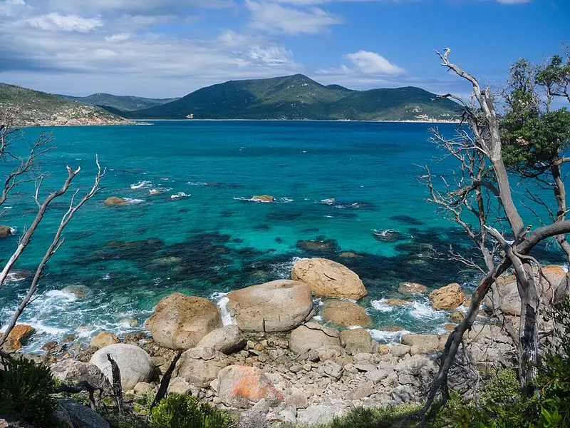
From Telegraph Saddle the track drops through rainforest and ferny gullies to Sealers Cove, about 10 km and 3 hours. The last stretch crosses the Sealers Cove swamp on a boardwalk, rebuilt as an 1,850 metre structure after storms in 2021 destroyed the old one. Sealers Cove to Refuge Cove is 6.4 km over Horn Point, with views up Five Mile Beach. Refuge Cove to Little Waterloo Bay is another 6.4 km around a rocky headland, with a short side trip to Kersops Peak, then along Waterloo Bay. From the southern end of Waterloo Bay the track climbs 9.8 km to the lightstation, which stands 100 metres above Bass Strait. The final leg runs from Telegraph Junction through coastal tea tree to Oberon Bay, then over the headlands to Little Oberon Bay and Tidal River. From Roaring Meg you can walk out to South Point.
Every leg is Grade 4 under the Australian Walking Track Grading System: steep, rocky, uneven sections that suit walkers with some experience. The creek crossings at Sealers Cove and Oberon Bay can be deep, so check tide times.
Camping and water
Overnight hikers must book before they start, and bookings are per person rather than per site. You can stay at most two nights in a row at any one camp, and groups are limited to 12. The hike in camps are Sealers Cove, Refuge Cove, Little Waterloo Bay, Roaring Meg, Halfway Hut and Oberon Bay. Most have toilets and untreated creek or tank water, and supply is not guaranteed, so carry a way to treat it. Camping is not allowed at the lightstation, which has its own booked cottages and cabins, with no supplies for sale. Fires, including campfires, are banned in the park at all times.
Getting there
Tidal River is about three hours from Melbourne and 30 minutes inside the park entrance. There is no fuel at Tidal River; the nearest is at Yanakie. On weekends from Melbourne Cup to Easter and in the summer, autumn and spring school holidays, a free shuttle runs from Tidal River and the overnight hikers car park to Telegraph Saddle, and the Telegraph Saddle car park is closed to other vehicles while it runs. Overnight hikers need a permit displayed on their car.
Before you go
Mobile reception is unreliable on the circuit. Leave your itinerary with an emergency contact. The park closes on Catastrophic Fire Danger days. Dogs, bikes and drones without a permit are not allowed. Check the Southern Circuit overnight hikes page, which carries the park's current alerts, before you go.
Elevation
- Climb
- 1,700 m
- Descent
- 1,900 m
- Highest
- 334 m
- Lowest
- 2 m
Approximate, from a 30 m terrain model, so it can overstate the climb on cliff edge tracks.
Before you go
Tell your people where you are going
Set your route and return time in FriendsFindMe. If you do not check in, the people you trust are sent a text so they know to come looking for you.
Park and state forest boundaries: CAPAD 2024 © Commonwealth of Australia (DCCEEW), CC BY 4.0; © Forestry Corporation of NSW, CC BY 3.0 AU; © State of Queensland, CC BY 4.0; © State of Victoria (DEECA), CC BY 4.0
Walk data: © State of Victoria (Department of Energy, Environment and Climate Action; Department of Jobs, Skills, Industry and Regions), CC BY 4.0