
About this walk
This is the northern start of the Yuraygir coastal walk, the 65km signposted route along the Clarence Coast from Angourie to Red Rock in Yuraygir National Park. This stretch begins at Mara Creek picnic area, just south of Angourie, and runs south past Shelley Headland and Lake Arragan to Red Cliff. It makes up most of the Angourie to Brooms Head walking track, which carries on another few kilometres from Red Cliff into Brooms Head. That full section is 18km one way, 6 to 7 hours, Grade 4.
Along the way
Mara Creek flows out across Back Beach near the start. If the tide is high, leave the sand midway along Back Beach at a tall post and take the inland track. Further south you pass caves on the southern side of Shelley headland, then Shelley Head campground, close to Shelley Caves and Little Shelley Beach. Beyond Shelley Beach the track reaches Lake Arragan, a small coastal lagoon ringed by paperbarks, and the open views at Red Cliff, where the Red Cliffs lookout suits whale watchers. Humpbacks pass between June and October, dolphins are seen all year, and the endangered coastal emu still lives here, though there are fewer than a hundred in the park. Interpretive signs along the way explain the area's importance to the Yaegl people, and in spring the woods around Shelley Head flower with Christmas bells, flannel flowers and orchids.
Underfoot
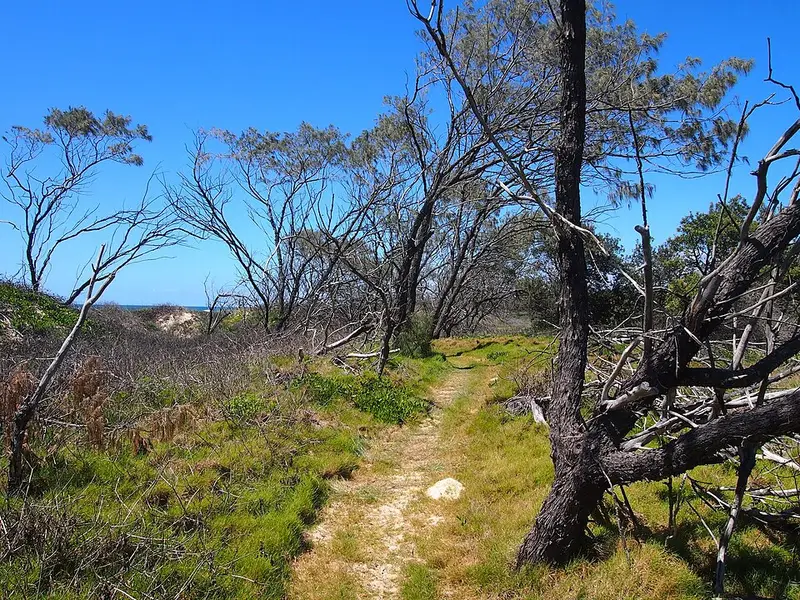
It is a signposted, formed track with some obstacles and short steep hills, suited to experienced bushwalkers, mixed with beach walking and rock platforms. Cross rock platforms only at low tide, and check a tide chart before you start. The walk is marked with a coastal emu footprint, and walking north to south keeps the sun behind you.
Getting there and facilities
Turn off the Pacific Highway at Harwood for Yamba, then turn right at the Yamba roundabout for Angourie. There is parking at Angourie Surfing Reserve, Angourie picnic area, Mara Creek, Lake Arragan and Brooms Head, and toilets at Angourie Bay, Shelley Headland, Lake Arragan and Brooms Head. Shelley Head campground is walk in only, about 6km south of Angourie, with 10 sites and toilets; carry your water. Lake Arragan and Red Cliff campgrounds have 89 sites, toilets and drinking water. Book campsites online, and note that park entry fees apply.
Before you go
Beaches here are unpatrolled with strong rips, and the cliffs at Lake Arragan and Red Cliff are unstable, so stay well back from edges. Mobile reception is limited, and pets are not permitted. Check the Yuraygir National Park alerts before you go.
Elevation
- Climb
- 130 m
- Descent
- 120 m
- Highest
- 58 m
- Lowest
- 3 m
Approximate, from a 30 m terrain model, so it can overstate the climb on cliff edge tracks.
Before you go
Tell your people where you are going
Set your route and return time in FriendsFindMe. If you do not check in, the people you trust are sent a text so they know to come looking for you.
Park and state forest boundaries: CAPAD 2024 © Commonwealth of Australia (DCCEEW), CC BY 4.0; © Forestry Corporation of NSW, CC BY 3.0 AU; © State of Queensland, CC BY 4.0; © State of Victoria (DEECA), CC BY 4.0
Walk data: © State of New South Wales (NSW National Parks and Wildlife Service), CC BY 4.0