
About this walk
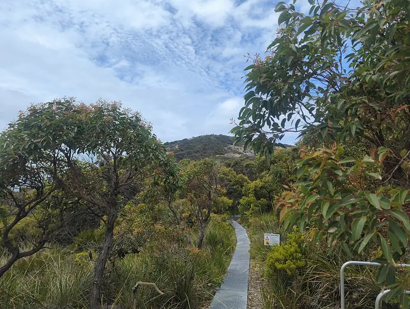
The Bald Head Walk Trail runs the length of the Flinders Peninsula in Torndirrup National Park, the granite coast just south of Albany on the Menang people's country. It climbs over Isthmus Hill, follows the ridgeline of the peninsula past Limestone Head, and ends at Bald Head, a rounded dome of granite sloping into the ocean at the park's eastern tip, which you can pick out from much of the Torndirrup coast. The views run south over the Southern Ocean and north over King George Sound. This is the walk one way, from the car park to Bald Head.
It is Grade 4, difficult: 12.5 km return, 6 to 8 hours, needing a high level of fitness, experience and preparation. Walk back the same way, and do not return along the beaches, because of hazards you cannot see.
What it is like
The track is long, rough in places and steep and difficult in sections. The surface is a mix of boardwalk, packed limestone path, bare granite and sand, with many steps that you climb in both directions, and the path can be hard to pick on granite and sand, where markers are sparse. Park upgrades included track surface work and minor realignments along the length of the trail. The ridge is exposed to strong wind and changing weather, so carry layers and rain gear. Spring brings the park's wildflowers, and whales pass the coast in the winter months.
Getting there and facilities
The trailhead is off Murray Road, reached by 2WD; Albany is a short drive away and Perth about 400 km. The Bald Head car park was enlarged in the park upgrades, which also added picnic facilities and interpretation panels there under the name Doggerdirrup Walk Trail. A new accessible toilet at Bald Head was part of the upgrade works, but plan as if there is none. There is no water on the trail: carry at least 1 litre per person for every hour of walking, plus food and a spare.
Park entry fees apply: $17 for a standard vehicle ($10 concession), or a valid park pass. Dogs and other pets are not allowed in the park, and bikes are not permitted on the trail. Fishing is allowed at Bald Head.
Before you go
The Torndirrup coast has a long record of people being swept off rocks by large waves, swells and gusts, so stay well back from the water's edge. Phone signal is patchy, so carry a personal locator beacon. The Albany Parks and Wildlife office is on (08) 9842 4500. Check DBCA park alerts and the Bald Head and Isthmus Hill page before you go.
Elevation
- Climb
- 320 m
- Descent
- 250 m
- Highest
- 223 m
- Lowest
- 42 m
Approximate, from a 30 m terrain model, so it can overstate the climb on cliff edge tracks.
Before you go
Tell your people where you are going
Set your route and return time in FriendsFindMe. If you do not check in, the people you trust are sent a text so they know to come looking for you.
Park and state forest boundaries: CAPAD 2024 © Commonwealth of Australia (DCCEEW), CC BY 4.0; © Forestry Corporation of NSW, CC BY 3.0 AU; © State of Queensland, CC BY 4.0; © State of Victoria (DEECA), CC BY 4.0
Walk data: © OpenStreetMap contributors, ODbL