
About this walk
Cape Woolamai is the headland at the eastern tip of Phillip Island, managed by Phillip Island Nature Parks as the Cape Woolamai Recreation Area. The Cape Woolamai circuit strings together all of the cape's walks: along the surf beach, up onto the cliffs to the Pinnacles, over the beacon at the island's highest point and back past an old granite quarry on Cleeland Bight. It is 8.1 kilometres and about 4.5 hours return, moderate, a loop from the Woolamai Beach car park and back.
The route
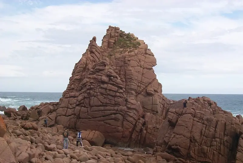
From the car park, walk down the ramp onto Woolamai Beach and turn left for about 900 metres to a staircase that climbs to the clifftops. The track then follows the cliffs to the Pinnacles, rock formations off the cliffs and one of the island's most visited sights. From there it climbs to the beacon lookout, at 112 metres the highest point on Phillip Island, with views over the whole island, San Remo and, on a clear day, Wilsons Promontory. The track continues through banksia woodland to a junction, turns down to the cove that was a busy granite quarry in the late 1800s, then follows the sand of Cleeland Bight and returns to the road and car park through coastal scrub. Shorter options are the Pinnacles return, the quarry loop and the beacon loop, each signposted with coloured markers.
What it is like
The tracks are well formed and signposted, but some bushwalking experience is recommended. Expect a slight but steady climb, some steps, uneven ground in places and steep cliffs right beside the track. The cape is exposed and the weather can change quickly, so bring water and a jacket. Cleeland Bight can be impassable on a very high tide, so check tide times before you set out. Copperheads, the only snake on Phillip Island, are about in warm weather; they are venomous, so leave them alone.
Wildlife and history
About half a million short tailed shearwaters nest in burrows on the cape, arriving in late September after flying about 16,000 kilometres from the Aleutian Islands near Alaska, and leaving around April. Stay on the tracks, because burrows collapse easily. Hooded plovers nest on the beach, so walk near the water's edge and keep clear of roped off areas. From late May to early July you may see humpback and southern right whales passing. The dunes hold middens, ancient piles of shell, bone and charcoal left by Aboriginal people over thousands of years, and they are protected.
Facilities and rules
Woolamai Beach Road leads to the sealed car park, which has toilets, including accessible ones. Dogs and bicycles are not permitted on the walks. The surf beach is a popular surfing spot: swim only between the flags on a patrolled day. Check conditions on the Phillip Island Nature Parks Cape Woolamai page, which also has a downloadable map, and the Visit Bass Coast Cape Woolamai walks page before you go.
Elevation
- Climb
- 190 m
- Descent
- 170 m
- Highest
- 105 m
- Lowest
- 3 m
Approximate, from a 30 m terrain model, so it can overstate the climb on cliff edge tracks.
Before you go
Tell your people where you are going
Set your route and return time in FriendsFindMe. If you do not check in, the people you trust are sent a text so they know to come looking for you.
Park and state forest boundaries: CAPAD 2024 © Commonwealth of Australia (DCCEEW), CC BY 4.0; © Forestry Corporation of NSW, CC BY 3.0 AU; © State of Queensland, CC BY 4.0; © State of Victoria (DEECA), CC BY 4.0
Walk data: © OpenStreetMap contributors, ODbL