
About this walk
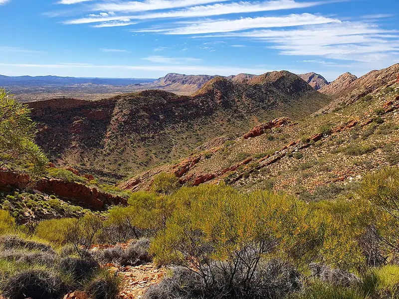
Section 4 of the Larapinta Trail climbs out of Standley Chasm and follows the high quartzite ridges of the Chewings Range west to the Section 4/5 Junction near Birthday Waterhole. It is 17.9 kilometres and about 8.5 hours, with a further 0.9 kilometres from the junction to Birthday Waterhole itself. It is Grade 5, the hardest grade on the trail: very rough track with very long steep sections, for experienced walkers who can navigate and have a high level of fitness. Allow 2 days.
The full Larapinta Trail runs more than 230 kilometres in 12 sections from Alice Springs to Mount Sonder.
The route
From Standley Chasm it is 4.9 kilometres to Bridle Path Lookout and another half kilometre to Reveal Saddle. The big climb follows: 4.5 kilometres to the summit of Brinkley Bluff, 1,209 metres, with views in every direction. The trail then drops steeply, 1.6 kilometres to Rocky Cleft and 2.8 kilometres to Stuart's Pass, an upper branch of the Hugh River, and follows that valley 2.4 kilometres to Mintbush Spring and 1.2 kilometres to the 4/5 Junction. It is one of the two most demanding sections on the trail, alongside Section 5.
Camping and water
Brinkley Bluff summit and Stuarts Pass are designated campsites, and a night on the summit is recommended for the sunrise. Neither has a water tank, and Brinkley Bluff has a composting toilet. The water tanks are at Standley Chasm, which has bore water, and the 4/5 Junction, 17.9 kilometres apart with nothing in between, so carry enough for the whole section plus cooking. Bring your own toilet paper and a kit to carry out waste where there is no toilet. Fires are banned.
Access
Standley Chasm is reached by conventional car during its opening hours. It is privately run, and walkers passing through on sections 3 and 4 pay its entry fee as well as any camping fee; phone 08 8956 7440. Birthday Waterhole is 14.4 kilometres off Namatjira Drive by high clearance 4WD, about an hour's drive.
Before you go
Walking and camping fees apply and every campsite must be booked online before you set out. Interstate visitors need an NT Parks Visitor Pass. The recommended season is April to September; from October to April temperatures can exceed 40°C. Walk with at least two other people, carry a personal locator beacon or satellite phone, and write in each trailhead logbook.
See the section 4 information sheet and map, then check whether the park is open and the Larapinta Trail current conditions before you go.
Elevation
- Climb
- 640 m
- Descent
- 690 m
- Highest
- 1,200 m
- Lowest
- 694 m
Approximate, from a 30 m terrain model, so it can overstate the climb on cliff edge tracks.
Before you go
Tell your people where you are going
Set your route and return time in FriendsFindMe. If you do not check in, the people you trust are sent a text so they know to come looking for you.
Park and state forest boundaries: CAPAD 2024 © Commonwealth of Australia (DCCEEW), CC BY 4.0; © Forestry Corporation of NSW, CC BY 3.0 AU; © State of Queensland, CC BY 4.0; © State of Victoria (DEECA), CC BY 4.0
Walk data: © OpenStreetMap contributors, ODbL