
About this walk
The Three Capes Track is a four day, three night hut walk along the cliffs of Tasman National Park on the Tasman Peninsula, south east of Hobart. It is 48 kilometres, Grade 3, which means some bushwalking experience is recommended and you can expect short steep hills, a rough surface in places and many steps. This walk runs from Denmans Cove, where the boat drops you, to Fortescue Bay, where the walk ends, and it includes the out and back to Cape Pillar.
The route
The walk is one way, and you must stay one night at each of the three cabin sites: Surveyors, Munro and Retakunna. The days are 4 km to Surveyors (1.5 to 2 hours), 11 km over Arthurs Peak and across the Ellarwey Valley to Munro (4 to 4.5 hours), 19 km out to Cape Pillar and The Blade and back past Munro to Retakunna (about 6 hours, with about 650 metres of climbing), then 14 km over Mount Fortescue, out to Cape Hauy and the dolerite columns of the Totem Pole, and down to Fortescue Bay (6 to 7 hours). On day three you can leave your pack at Munro and walk to Cape Pillar with a day pack.
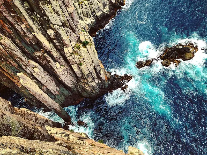
The track is about a metre wide, built to a dry boot standard from timber boardwalk, gravel and stone steps. It passes tall eucalypt forest, coastal heath and moorland, and runs close to some of the highest sea cliffs in Australia. There are no barriers at the edges: stay at least 2 metres back and use the built viewing points.
Bookings, fees and getting there
Bookings are essential and up to 48 walkers start each day. The fee (standard adult rate $650 at the time of writing, reviewed each year) covers three nights in the cabins, the cruise from Port Arthur to Denmans Cove, entry to the Port Arthur Historic Site, parking and lockers, the bus from Fortescue Bay back to Port Arthur, the guidebook and park entry for the walk. Port Arthur is about 90 minutes south east of Hobart on the Arthur Highway, and buses run there from Hobart. You check in at the Port Arthur visitor centre. At Denmans Cove you may have to wade ashore, sometimes knee deep between September and December.
Facilities
Each cabin site has shared bunk rooms with mattresses (unheated, so bring a sleeping bag rated to about minus 5 degrees), a heated kitchen with gas cooktops and pots, toilets and untreated rainwater from tanks. Carry about 2 litres a day and treat it. Munro has outdoor showers. You bring all your food and your own plate, bowl, cup and cutlery. The park is a fuel stove only area, so no campfires.
Before you go
Summer days average 16 to 19 degrees and winter days 10 to 12, but wind and rain can come in any season. Mobile reception is patchy, with limited coverage around Munro. The track closes for about two weeks each April for maintenance and burns. Check the Parks and Wildlife Service alerts page and the Three Capes Track page before you go.
Elevation
- Climb
- 2,900 m
- Descent
- 2,900 m
- Highest
- 488 m
- Lowest
- 0 m
Approximate, from a 30 m terrain model, so it can overstate the climb on cliff edge tracks.
Before you go
Tell your people where you are going
Set your route and return time in FriendsFindMe. If you do not check in, the people you trust are sent a text so they know to come looking for you.
Park and state forest boundaries: CAPAD 2024 © Commonwealth of Australia (DCCEEW), CC BY 4.0; © Forestry Corporation of NSW, CC BY 3.0 AU; © State of Queensland, CC BY 4.0; © State of Victoria (DEECA), CC BY 4.0
Walk data: © OpenStreetMap contributors, ODbL