
About this walk
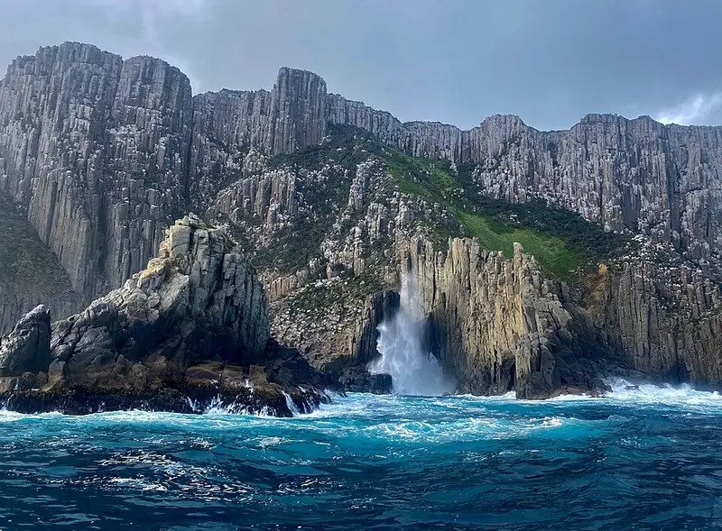
The Cape Pillar Track runs to Cape Pillar, the south eastern tip of the Tasman Peninsula in Tasman National Park, where sea cliffs about 300 metres high, among the tallest in the Southern Hemisphere, face Tasman Island across a narrow passage. This walk starts at the crossroads on Tornado Ridge, beside Retakunna cabin, where the Old Cape Pillar Track from Fortescue Bay meets the Three Capes Track, and ends at the lookouts by The Blade at the tip of the cape.
Who walks it
Two kinds of walker use this track. Three Capes Track walkers pass along it on their third day, walking from Munro cabin out to Cape Pillar and back, then on to Retakunna. Independent walkers reach it from Fortescue Bay on the Old Cape Pillar Track, about 2 hours to Tornado Ridge, and continue south east. The independent trip takes 2 to 3 days: 29 kilometres return via the Old Cape Pillar Track, or a 34 kilometre circuit back over Mount Fortescue and out to Cape Hauy, which can only be walked south to north. It is Grade 3: some bushwalking experience recommended, with short steep hills, rough surfaces and many steps. At the crossroads independent walkers may not turn west along the Three Capes Track.
What it is like
The track crosses forest, heath and moorland on the way to the cape, past Munro cabin, and finishes with the climb onto The Blade, looking across to Tasman Island. The Cape Pillar sheoak, Allocasuarina crassa, grows only on about 20 square kilometres around the cape and on Tasman Island. The cliffs near the cape are sheer and unfenced: stay at least 2 metres back from exposed edges and expect strong, gusty winds on the way out.
Camping and facilities
The cabins along the way are only for Three Capes Track walkers. Independent walkers camp at Bare Knoll, about 1 kilometre from the crossroads towards Cape Pillar, on the right of the track, which has 12 tent platforms and a toilet. Register your stay and walk plans at the Fortescue Bay site office before you set out. Carry in your water, because natural sources cannot be relied on. The park is fuel stove only.
Before you go
The track closes for about two weeks each April for maintenance and fuel reduction burns; the dates are on the Cape Pillar page. You need a valid Tasmanian national parks pass. Check the Parks and Wildlife Service alerts page before you go, and see the Three Capes Track page if you are walking with a booked Three Capes pass.
Elevation
- Climb
- 760 m
- Descent
- 910 m
- Highest
- 318 m
- Lowest
- 9 m
Approximate, from a 30 m terrain model, so it can overstate the climb on cliff edge tracks.
Before you go
Tell your people where you are going
Set your route and return time in FriendsFindMe. If you do not check in, the people you trust are sent a text so they know to come looking for you.
Park and state forest boundaries: CAPAD 2024 © Commonwealth of Australia (DCCEEW), CC BY 4.0; © Forestry Corporation of NSW, CC BY 3.0 AU; © State of Queensland, CC BY 4.0; © State of Victoria (DEECA), CC BY 4.0
Walk data: LIST Transport Segments from theLIST © State of Tasmania, CC BY 3.0 AU