
About this walk
The Coomera circuit follows the Coomera River up its gorge in the Binna Burra section of Lamington National Park, with a cantilevered lookout over two big waterfalls. The whole circuit is 17.4 kilometres from the Binna Burra trailhead, about 7 hours, on a Grade 4 track (bushwalking experience recommended; tracks can be long, rough and steep). Walk it anticlockwise. This walk is the circuit's own track, from where it leaves the Border Track up the gorge to where it rejoins the Border Track further south; the Border Track legs at each end are not included.
What you see
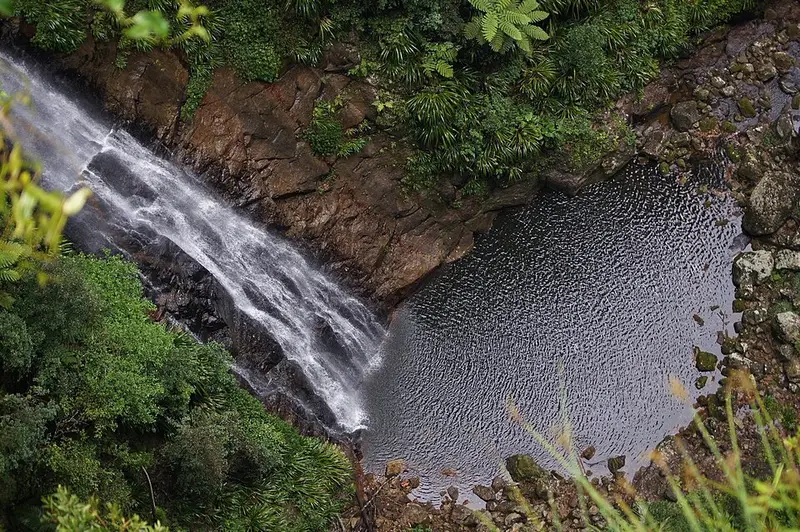
The circuit leaves the Border Track 1.9 kilometres from the trailhead and passes through subtropical and warm temperate rainforest and a forest of giant brush box trees. About 5.5 kilometres from the trailhead you reach the Coomera Falls lookout, built out over the edge, where the Coomera River pours over Coomera and Yarrabilgong falls into a gorge 160 metres deep. The track keeps climbing along the edge of the gorge, beside the river and past a series of smaller cascades and falls; look for the bright blue and white Lamington spiny crayfish. After several river crossings it rejoins the Border Track for the walk back to Binna Burra.
River crossings
The crossings involve stepping from rock to rock and can be hazardous after heavy rain. Do not cross when the river is flooding or during heavy rain, because you can be trapped between crossings, and flash floods can send a large volume of water down the gullies with little warning. Rocks can be slippery even when they look dry. Never jump or dive into the water.
Getting there and facilities
The Binna Burra upper day use area is at the end of Binna Burra Road, 3.5 kilometres from the park entrance. Allow about 70 minutes from Broadbeach, driving 38 kilometres to Beechmont via Nerang; the last 1.8 kilometres are very narrow and winding. There are flush toilets, picnic tables and free electric barbecues at the day use area. There is no public transport to the park.
Before you go
The Coomera Gorge area is a declared restricted access area, so stay on the track. Watch for leeches, ticks, snakes and stinging trees, and do not start a long walk after midday. Mobile coverage is unreliable. Leave your route and return time with someone reliable, and check the Queensland Parks alerts and the Coomera circuit page before you go.
Elevation
- Climb
- 240 m
- Descent
- 210 m
- Highest
- 959 m
- Lowest
- 722 m
Approximate, from a 30 m terrain model, so it can overstate the climb on cliff edge tracks.
Before you go
Tell your people where you are going
Set your route and return time in FriendsFindMe. If you do not check in, the people you trust are sent a text so they know to come looking for you.
Park and state forest boundaries: CAPAD 2024 © Commonwealth of Australia (DCCEEW), CC BY 4.0; © Forestry Corporation of NSW, CC BY 3.0 AU; © State of Queensland, CC BY 4.0; © State of Victoria (DEECA), CC BY 4.0
Walk data: Queensland Parks and Wildlife Service access © The State of Queensland 2025, CC BY 4.0