
About this walk
The Sunshine Coast Hinterland Great Walk crosses 58.8 kilometres of the Blackall Range west of the Sunshine Coast, from Baroon Pocket Dam near Montville to the Delicia Road entrance near Mapleton, with three walkers' camps on the way. Allow at least four days for the whole walk.
This is the southern end of the walk, through Kondalilla National Park from near Kondalilla Falls Road down to Baroon Pocket Dam. This is the first two legs of Section 1 walked in reverse: Baroon Pocket Dam to Baroon lookout (2.2 km, allow 1 to 2 hours, Grade 3) and Baroon lookout to the Kondalilla day use area (9.2 km, allow 5 to 6 hours, Grade 3 and 4).
What you see
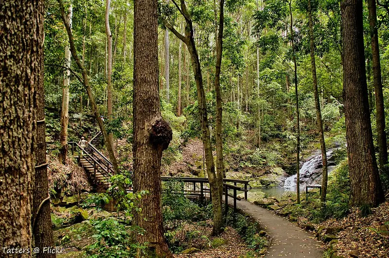
Kondalilla Falls is where Skene Creek drops 90 metres into rainforest, and it is at its best in the summer wet season. Below the escarpment the track follows Obi Obi Creek through patches of rainforest, crossing many of its side gullies, and Flat Rock on the way is a good rest stop. Look up for bunya pines standing above the canopy. A steep climb leads to Baroon lookout, with views over Obi Obi Gorge and Baroon Pocket Dam. Closer to the dam, open woodland ridges, bridges and boardwalks cross palm lined streams. A 225 metre spur reaches Narrows lookout over the Narrows Gorge, and a 265 metre spur reaches Obi Obi Creek. Stay on the boardwalk in the gully below Baroon lookout, which protects habitat for the hip pocket frog.
What it is like underfoot
Expect steep slopes, slippery rocks at creek crossings and mud after rain. Do not cross flooded creeks: they rise quickly and fall again, so wait. The Kondalilla Falls circuit beside this route has more than 300 steps. Domestic animals are not allowed in Kondalilla National Park.
Getting there
For the dam end, drive from Montville toward Baroon Pocket Dam via Western Avenue and Narrows Road, and turn into the Great Walk entrance car park just before the dam picnic area. For Kondalilla, turn west off the Montville Mapleton Road onto Kondalilla Falls Road. The Kondalilla day use area works as a pickup point. Take valuables, including house keys, out of parked cars. Montville, about 5.5 km from the dam entrance, is on the Sunshine Coast Hinterland bus route.
Before you go
Flaxton walkers' camp, 4.7 km on from Kondalilla, is the first camp for walkers heading north and must be booked. Carry 3 to 6 litres of water each a day and treat creek water. Read the QPWS walking page and the Kondalilla things to do page, and check Queensland park alerts before you go.
Elevation
- Climb
- 350 m
- Descent
- 520 m
- Highest
- 403 m
- Lowest
- 139 m
Approximate, from a 30 m terrain model, so it can overstate the climb on cliff edge tracks.
Before you go
Tell your people where you are going
Set your route and return time in FriendsFindMe. If you do not check in, the people you trust are sent a text so they know to come looking for you.
Park and state forest boundaries: CAPAD 2024 © Commonwealth of Australia (DCCEEW), CC BY 4.0; © Forestry Corporation of NSW, CC BY 3.0 AU; © State of Queensland, CC BY 4.0; © State of Victoria (DEECA), CC BY 4.0
Walk data: Queensland Parks and Wildlife Service access © The State of Queensland 2025, CC BY 4.0